You are here: Home > Network List > TA - USArray Transportable Network (new EarthScope stations) Stations List
> Station G21K Allakaket, AK, USA > Earthquake Result Viewer
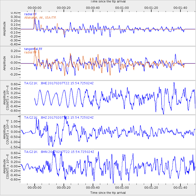
G21K Allakaket, AK, USA - Earthquake Result Viewer
*The percent match for this event was below the threshold and hence no stack was calculated.
| Earthquake location: |
Southwestern Pakistan |
| Earthquake latitude/longitude: |
25.2/63.3 |
| Earthquake time(UTC): |
2017/02/07 (038) 22:03:55 GMT |
| Earthquake Depth: |
24 km |
| Earthquake Magnitude: |
6.3 Mww |
| Earthquake Catalog/Contributor: |
NEIC PDE/us |
|
| Network: |
TA USArray Transportable Network (new EarthScope stations) |
| Station: |
G21K Allakaket, AK, USA |
| Lat/Lon: |
66.52 N/153.51 W |
| Elevation: |
446 m |
|
| Distance: |
84.4 deg |
| Az: |
13.945 deg |
| Baz: |
326.991 deg |
| Ray Param: |
$rayparam |
*The percent match for this event was below the threshold and hence was not used in the summary stack. |
|
| Radial Match: |
73.03476 % |
| Radial Bump: |
400 |
| Transverse Match: |
62.150715 % |
| Transverse Bump: |
400 |
| SOD ConfigId: |
11737051 |
| Insert Time: |
2019-04-26 18:35:53.260 +0000 |
| GWidth: |
2.5 |
| Max Bumps: |
400 |
| Tol: |
0.001 |
|
Signal To Noise
| Channel | StoN | STA | LTA |
| TA:G21K: :BHZ:20170207T22:15:54.725024Z | 3.0082166 | 5.280706E-7 | 1.7554275E-7 |
| TA:G21K: :BHN:20170207T22:15:54.725024Z | 0.9035671 | 1.1695729E-7 | 1.2943953E-7 |
| TA:G21K: :BHE:20170207T22:15:54.725024Z | 1.179881 | 2.8061024E-7 | 2.3782927E-7 |
| Arrivals |
| Ps | |
| PpPs | |
| PsPs/PpSs | |


