You are here: Home > Network List > TA - USArray Transportable Network (new EarthScope stations) Stations List
> Station R31K City Hall, Gustavus, AK, USA > Earthquake Result Viewer
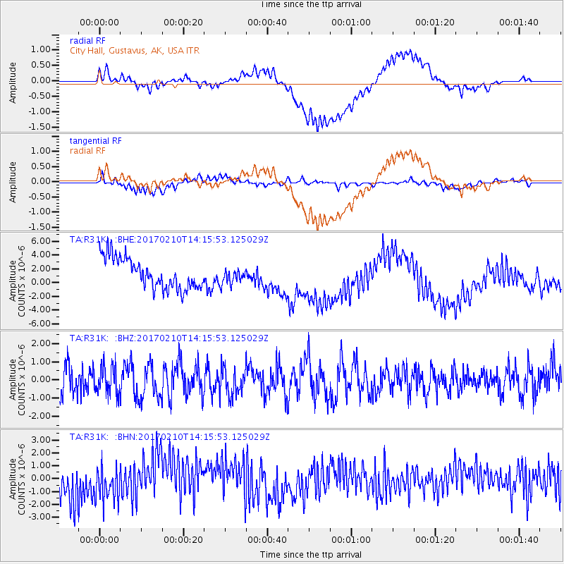
R31K City Hall, Gustavus, AK, USA - Earthquake Result Viewer
*The percent match for this event was below the threshold and hence no stack was calculated.
| Earthquake location: |
Mindanao, Philippines |
| Earthquake latitude/longitude: |
9.9/125.5 |
| Earthquake time(UTC): |
2017/02/10 (041) 14:03:43 GMT |
| Earthquake Depth: |
15 km |
| Earthquake Magnitude: |
6.5 mww |
| Earthquake Catalog/Contributor: |
NEIC PDE/us |
|
| Network: |
TA USArray Transportable Network (new EarthScope stations) |
| Station: |
R31K City Hall, Gustavus, AK, USA |
| Lat/Lon: |
58.41 N/135.74 W |
| Elevation: |
15 m |
|
| Distance: |
86.2 deg |
| Az: |
31.419 deg |
| Baz: |
282.635 deg |
| Ray Param: |
$rayparam |
*The percent match for this event was below the threshold and hence was not used in the summary stack. |
|
| Radial Match: |
33.484062 % |
| Radial Bump: |
400 |
| Transverse Match: |
40.138943 % |
| Transverse Bump: |
400 |
| SOD ConfigId: |
11737051 |
| Insert Time: |
2019-04-26 18:42:12.976 +0000 |
| GWidth: |
2.5 |
| Max Bumps: |
400 |
| Tol: |
0.001 |
|
Signal To Noise
| Channel | StoN | STA | LTA |
| TA:R31K: :BHZ:20170210T14:15:53.125029Z | 1.0836858 | 7.746635E-7 | 7.148414E-7 |
| TA:R31K: :BHN:20170210T14:15:53.125029Z | 1.099642 | 1.2444403E-6 | 1.1316778E-6 |
| TA:R31K: :BHE:20170210T14:15:53.125029Z | 0.46618295 | 1.0262131E-6 | 2.2013098E-6 |
| Arrivals |
| Ps | |
| PpPs | |
| PsPs/PpSs | |


