You are here: Home > Network List > CI - Caltech Regional Seismic Network Stations List
> Station MPM Manuel Prospect Mine, California, USA > Earthquake Result Viewer
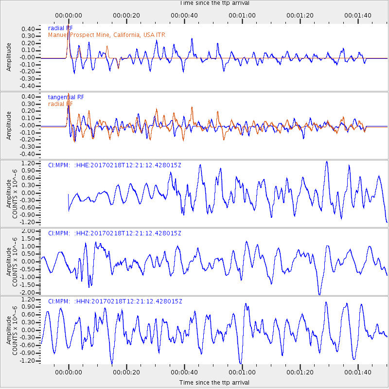
MPM Manuel Prospect Mine, California, USA - Earthquake Result Viewer
*The percent match for this event was below the threshold and hence no stack was calculated.
| Earthquake location: |
Jujuy Province, Argentina |
| Earthquake latitude/longitude: |
-23.9/-66.7 |
| Earthquake time(UTC): |
2017/02/18 (049) 12:10:15 GMT |
| Earthquake Depth: |
201 km |
| Earthquake Magnitude: |
6.3 Mww |
| Earthquake Catalog/Contributor: |
NEIC PDE/us |
|
| Network: |
CI Caltech Regional Seismic Network |
| Station: |
MPM Manuel Prospect Mine, California, USA |
| Lat/Lon: |
36.06 N/117.49 W |
| Elevation: |
185 m |
|
| Distance: |
76.6 deg |
| Az: |
319.788 deg |
| Baz: |
133.187 deg |
| Ray Param: |
$rayparam |
*The percent match for this event was below the threshold and hence was not used in the summary stack. |
|
| Radial Match: |
50.89485 % |
| Radial Bump: |
400 |
| Transverse Match: |
54.66676 % |
| Transverse Bump: |
400 |
| SOD ConfigId: |
11737051 |
| Insert Time: |
2019-04-26 18:54:41.877 +0000 |
| GWidth: |
2.5 |
| Max Bumps: |
400 |
| Tol: |
0.001 |
|
Signal To Noise
| Channel | StoN | STA | LTA |
| CI:MPM: :HHZ:20170218T12:21:12.428015Z | 1.546952 | 5.8033925E-7 | 3.7515014E-7 |
| CI:MPM: :HHN:20170218T12:21:12.428015Z | 1.4063178 | 4.4601387E-7 | 3.1715012E-7 |
| CI:MPM: :HHE:20170218T12:21:12.428015Z | 1.2402272 | 2.8408203E-7 | 2.2905643E-7 |
| Arrivals |
| Ps | |
| PpPs | |
| PsPs/PpSs | |


