You are here: Home > Network List > IC - New China Digital Seismograph Network Stations List
> Station KMI Kunming, Yunnan Province, China > Earthquake Result Viewer
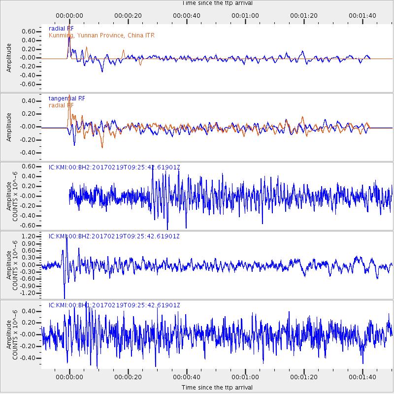
KMI Kunming, Yunnan Province, China - Earthquake Result Viewer
*The percent match for this event was below the threshold and hence no stack was calculated.
| Earthquake location: |
Near East Coast Of Honshu, Japan |
| Earthquake latitude/longitude: |
35.6/140.8 |
| Earthquake time(UTC): |
2017/02/19 (050) 09:19:30 GMT |
| Earthquake Depth: |
39 km |
| Earthquake Magnitude: |
5.5 mb |
| Earthquake Catalog/Contributor: |
NEIC PDE/us |
|
| Network: |
IC New China Digital Seismograph Network |
| Station: |
KMI Kunming, Yunnan Province, China |
| Lat/Lon: |
25.12 N/102.74 E |
| Elevation: |
1975 m |
|
| Distance: |
34.3 deg |
| Az: |
262.864 deg |
| Baz: |
63.087 deg |
| Ray Param: |
$rayparam |
*The percent match for this event was below the threshold and hence was not used in the summary stack. |
|
| Radial Match: |
67.215485 % |
| Radial Bump: |
400 |
| Transverse Match: |
69.50408 % |
| Transverse Bump: |
400 |
| SOD ConfigId: |
11737051 |
| Insert Time: |
2019-04-26 19:08:51.209 +0000 |
| GWidth: |
2.5 |
| Max Bumps: |
400 |
| Tol: |
0.001 |
|
Signal To Noise
| Channel | StoN | STA | LTA |
| IC:KMI:00:BHZ:20170219T09:25:42.61901Z | 6.368967 | 4.2307173E-7 | 6.6427056E-8 |
| IC:KMI:00:BH1:20170219T09:25:42.61901Z | 2.0096755 | 2.2168176E-7 | 1.1030724E-7 |
| IC:KMI:00:BH2:20170219T09:25:42.61901Z | 2.604317 | 2.7844092E-7 | 1.0691514E-7 |
| Arrivals |
| Ps | |
| PpPs | |
| PsPs/PpSs | |


