You are here: Home > Network List > TA - USArray Transportable Network (new EarthScope stations) Stations List
> Station G22K Bettles, AK, USA > Earthquake Result Viewer
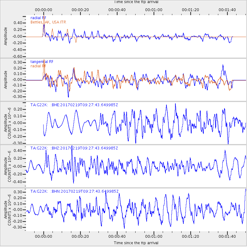
G22K Bettles, AK, USA - Earthquake Result Viewer
*The percent match for this event was below the threshold and hence no stack was calculated.
| Earthquake location: |
Near East Coast Of Honshu, Japan |
| Earthquake latitude/longitude: |
35.6/140.8 |
| Earthquake time(UTC): |
2017/02/19 (050) 09:19:30 GMT |
| Earthquake Depth: |
39 km |
| Earthquake Magnitude: |
5.5 mb |
| Earthquake Catalog/Contributor: |
NEIC PDE/us |
|
| Network: |
TA USArray Transportable Network (new EarthScope stations) |
| Station: |
G22K Bettles, AK, USA |
| Lat/Lon: |
66.92 N/151.51 W |
| Elevation: |
205 m |
|
| Distance: |
49.1 deg |
| Az: |
28.857 deg |
| Baz: |
265.781 deg |
| Ray Param: |
$rayparam |
*The percent match for this event was below the threshold and hence was not used in the summary stack. |
|
| Radial Match: |
49.47502 % |
| Radial Bump: |
400 |
| Transverse Match: |
58.331226 % |
| Transverse Bump: |
400 |
| SOD ConfigId: |
11737051 |
| Insert Time: |
2019-04-26 19:12:20.648 +0000 |
| GWidth: |
2.5 |
| Max Bumps: |
400 |
| Tol: |
0.001 |
|
Signal To Noise
| Channel | StoN | STA | LTA |
| TA:G22K: :BHZ:20170219T09:27:43.649985Z | 2.4024377 | 1.9653771E-7 | 8.180762E-8 |
| TA:G22K: :BHN:20170219T09:27:43.649985Z | 0.65973175 | 6.2436364E-8 | 9.463902E-8 |
| TA:G22K: :BHE:20170219T09:27:43.649985Z | 0.7509233 | 6.964573E-8 | 9.27468E-8 |
| Arrivals |
| Ps | |
| PpPs | |
| PsPs/PpSs | |


