You are here: Home > Network List > CI - Caltech Regional Seismic Network Stations List
> Station SMM Simmler, CA, USA > Earthquake Result Viewer
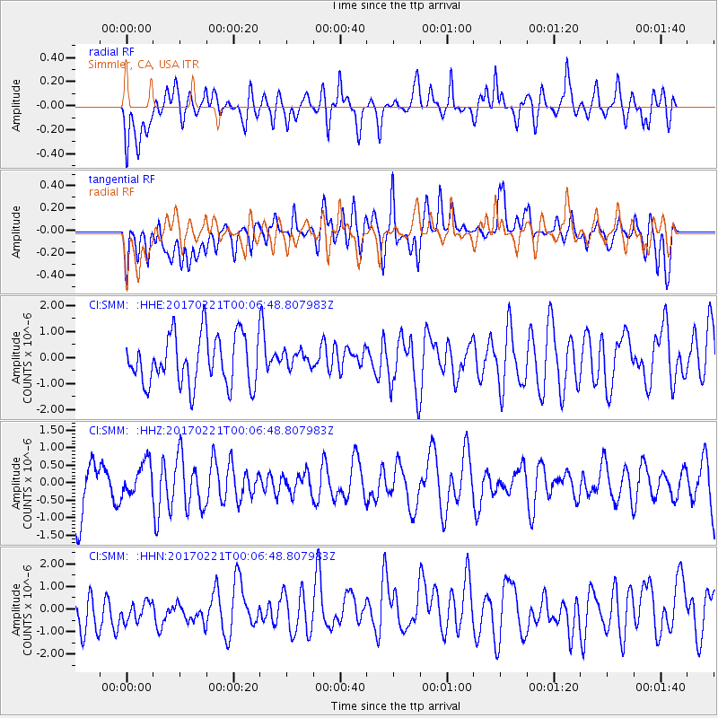
SMM Simmler, CA, USA - Earthquake Result Viewer
*The percent match for this event was below the threshold and hence no stack was calculated.
| Earthquake location: |
Fiji Islands Region |
| Earthquake latitude/longitude: |
-15.0/-176.4 |
| Earthquake time(UTC): |
2017/02/20 (051) 23:55:48 GMT |
| Earthquake Depth: |
6.0 km |
| Earthquake Magnitude: |
5.5 Mww |
| Earthquake Catalog/Contributor: |
NEIC PDE/us |
|
| Network: |
CI Caltech Regional Seismic Network |
| Station: |
SMM Simmler, CA, USA |
| Lat/Lon: |
35.31 N/120.00 W |
| Elevation: |
599 m |
|
| Distance: |
73.2 deg |
| Az: |
45.365 deg |
| Baz: |
237.238 deg |
| Ray Param: |
$rayparam |
*The percent match for this event was below the threshold and hence was not used in the summary stack. |
|
| Radial Match: |
61.287853 % |
| Radial Bump: |
400 |
| Transverse Match: |
49.13515 % |
| Transverse Bump: |
400 |
| SOD ConfigId: |
11737051 |
| Insert Time: |
2019-04-26 19:17:45.930 +0000 |
| GWidth: |
2.5 |
| Max Bumps: |
400 |
| Tol: |
0.001 |
|
Signal To Noise
| Channel | StoN | STA | LTA |
| CI:SMM: :HHZ:20170221T00:06:48.807983Z | 0.54986507 | 4.7046785E-7 | 8.5560595E-7 |
| CI:SMM: :HHN:20170221T00:06:48.807983Z | 0.6411047 | 5.6779436E-7 | 8.8565E-7 |
| CI:SMM: :HHE:20170221T00:06:48.807983Z | 0.32720226 | 3.1194952E-7 | 9.5338436E-7 |
| Arrivals |
| Ps | |
| PpPs | |
| PsPs/PpSs | |


