You are here: Home > Network List > TA - USArray Transportable Network (new EarthScope stations) Stations List
> Station G21K Allakaket, AK, USA > Earthquake Result Viewer
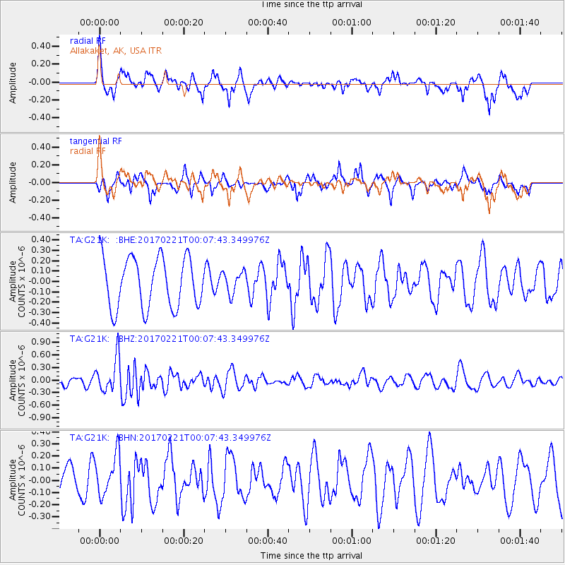
G21K Allakaket, AK, USA - Earthquake Result Viewer
*The percent match for this event was below the threshold and hence no stack was calculated.
| Earthquake location: |
Fiji Islands Region |
| Earthquake latitude/longitude: |
-15.0/-176.4 |
| Earthquake time(UTC): |
2017/02/20 (051) 23:55:48 GMT |
| Earthquake Depth: |
6.0 km |
| Earthquake Magnitude: |
5.5 Mww |
| Earthquake Catalog/Contributor: |
NEIC PDE/us |
|
| Network: |
TA USArray Transportable Network (new EarthScope stations) |
| Station: |
G21K Allakaket, AK, USA |
| Lat/Lon: |
66.52 N/153.51 W |
| Elevation: |
446 m |
|
| Distance: |
83.0 deg |
| Az: |
9.03 deg |
| Baz: |
202.241 deg |
| Ray Param: |
$rayparam |
*The percent match for this event was below the threshold and hence was not used in the summary stack. |
|
| Radial Match: |
70.914925 % |
| Radial Bump: |
349 |
| Transverse Match: |
43.374317 % |
| Transverse Bump: |
311 |
| SOD ConfigId: |
11737051 |
| Insert Time: |
2019-04-26 19:21:02.889 +0000 |
| GWidth: |
2.5 |
| Max Bumps: |
400 |
| Tol: |
0.001 |
|
Signal To Noise
| Channel | StoN | STA | LTA |
| TA:G21K: :BHZ:20170221T00:07:43.349976Z | 4.352341 | 4.1934996E-7 | 9.635043E-8 |
| TA:G21K: :BHN:20170221T00:07:43.349976Z | 1.0908709 | 1.7033847E-7 | 1.5614907E-7 |
| TA:G21K: :BHE:20170221T00:07:43.349976Z | 0.45058373 | 1.07837195E-7 | 2.3932776E-7 |
| Arrivals |
| Ps | |
| PpPs | |
| PsPs/PpSs | |


