You are here: Home > Network List > CI - Caltech Regional Seismic Network Stations List
> Station TIN Tinemaha, Big Pine, CA, USA > Earthquake Result Viewer
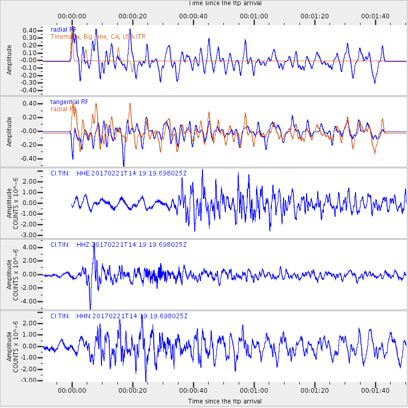
TIN Tinemaha, Big Pine, CA, USA - Earthquake Result Viewer
*The percent match for this event was below the threshold and hence no stack was calculated.
| Earthquake location: |
Southern Bolivia |
| Earthquake latitude/longitude: |
-19.3/-63.9 |
| Earthquake time(UTC): |
2017/02/21 (052) 14:09:04 GMT |
| Earthquake Depth: |
598 km |
| Earthquake Magnitude: |
6.5 Mww |
| Earthquake Catalog/Contributor: |
NEIC PDE/us |
|
| Network: |
CI Caltech Regional Seismic Network |
| Station: |
TIN Tinemaha, Big Pine, CA, USA |
| Lat/Lon: |
37.05 N/118.23 W |
| Elevation: |
1197 m |
|
| Distance: |
75.9 deg |
| Az: |
317.923 deg |
| Baz: |
127.7 deg |
| Ray Param: |
$rayparam |
*The percent match for this event was below the threshold and hence was not used in the summary stack. |
|
| Radial Match: |
77.4895 % |
| Radial Bump: |
400 |
| Transverse Match: |
74.01144 % |
| Transverse Bump: |
400 |
| SOD ConfigId: |
11737051 |
| Insert Time: |
2019-04-26 19:25:31.865 +0000 |
| GWidth: |
2.5 |
| Max Bumps: |
400 |
| Tol: |
0.001 |
|
Signal To Noise
| Channel | StoN | STA | LTA |
| CI:TIN: :HHZ:20170221T14:19:19.698025Z | 2.2121873 | 5.004218E-7 | 2.262113E-7 |
| CI:TIN: :HHN:20170221T14:19:19.698025Z | 1.3224049 | 5.1558504E-7 | 3.898844E-7 |
| CI:TIN: :HHE:20170221T14:19:19.698025Z | 0.9937327 | 3.5545133E-7 | 3.5769312E-7 |
| Arrivals |
| Ps | |
| PpPs | |
| PsPs/PpSs | |


