You are here: Home > Network List > US - United States National Seismic Network Stations List
> Station EGMT Eagleton, Montana, USA > Earthquake Result Viewer
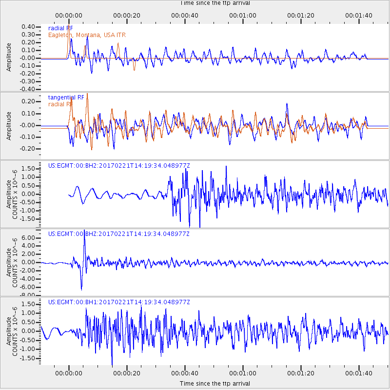
EGMT Eagleton, Montana, USA - Earthquake Result Viewer
*The percent match for this event was below the threshold and hence no stack was calculated.
| Earthquake location: |
Southern Bolivia |
| Earthquake latitude/longitude: |
-19.3/-63.9 |
| Earthquake time(UTC): |
2017/02/21 (052) 14:09:04 GMT |
| Earthquake Depth: |
598 km |
| Earthquake Magnitude: |
6.5 Mww |
| Earthquake Catalog/Contributor: |
NEIC PDE/us |
|
| Network: |
US United States National Seismic Network |
| Station: |
EGMT Eagleton, Montana, USA |
| Lat/Lon: |
48.02 N/109.75 W |
| Elevation: |
1055 m |
|
| Distance: |
78.6 deg |
| Az: |
330.562 deg |
| Baz: |
136.247 deg |
| Ray Param: |
$rayparam |
*The percent match for this event was below the threshold and hence was not used in the summary stack. |
|
| Radial Match: |
68.58074 % |
| Radial Bump: |
400 |
| Transverse Match: |
74.30219 % |
| Transverse Bump: |
400 |
| SOD ConfigId: |
11737051 |
| Insert Time: |
2019-04-26 19:34:30.990 +0000 |
| GWidth: |
2.5 |
| Max Bumps: |
400 |
| Tol: |
0.001 |
|
Signal To Noise
| Channel | StoN | STA | LTA |
| US:EGMT:00:BHZ:20170221T14:19:34.048977Z | 13.1622 | 1.7798578E-6 | 1.3522495E-7 |
| US:EGMT:00:BH1:20170221T14:19:34.048977Z | 0.6572029 | 2.0830335E-7 | 3.169544E-7 |
| US:EGMT:00:BH2:20170221T14:19:34.048977Z | 1.4140364 | 2.8411498E-7 | 2.0092479E-7 |
| Arrivals |
| Ps | |
| PpPs | |
| PsPs/PpSs | |


