You are here: Home > Network List > GS - US Geological Survey Networks Stations List
> Station KAN11 Stewart Ranch, Harper County, KS, USA > Earthquake Result Viewer
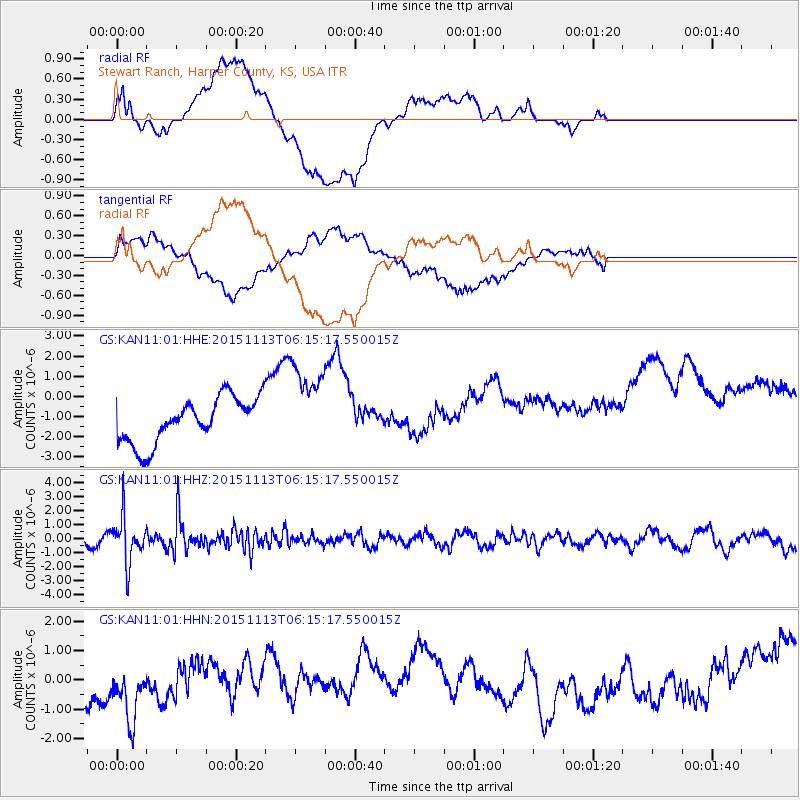
KAN11 Stewart Ranch, Harper County, KS, USA - Earthquake Result Viewer
*The percent match for this event was below the threshold and hence no stack was calculated.
| Earthquake location: |
Santiago Del Estero Prov., Arg. |
| Earthquake latitude/longitude: |
-29.9/-64.5 |
| Earthquake time(UTC): |
2015/11/13 (317) 06:04:15 GMT |
| Earthquake Depth: |
11 km |
| Earthquake Magnitude: |
5.8 MWP |
| Earthquake Catalog/Contributor: |
NEIC PDE/NEIC COMCAT |
|
| Network: |
GS US Geological Survey Networks |
| Station: |
KAN11 Stewart Ranch, Harper County, KS, USA |
| Lat/Lon: |
37.21 N/97.91 W |
| Elevation: |
410 m |
|
| Distance: |
73.7 deg |
| Az: |
332.737 deg |
| Baz: |
150.109 deg |
| Ray Param: |
$rayparam |
*The percent match for this event was below the threshold and hence was not used in the summary stack. |
|
| Radial Match: |
25.7472 % |
| Radial Bump: |
400 |
| Transverse Match: |
21.63713 % |
| Transverse Bump: |
400 |
| SOD ConfigId: |
1259291 |
| Insert Time: |
2015-11-27 06:24:05.234 +0000 |
| GWidth: |
2.5 |
| Max Bumps: |
400 |
| Tol: |
0.001 |
|
Signal To Noise
| Channel | StoN | STA | LTA |
| GS:KAN11:01:HHZ:20151113T06:15:17.550015Z | 3.9257503 | 1.6567058E-6 | 4.2200998E-7 |
| GS:KAN11:01:HHN:20151113T06:15:17.550015Z | 1.5403107 | 1.3866861E-6 | 9.0026384E-7 |
| GS:KAN11:01:HHE:20151113T06:15:17.550015Z | 1.9304999 | 2.147975E-6 | 1.1126522E-6 |
| Arrivals |
| Ps | |
| PpPs | |
| PsPs/PpSs | |


