You are here: Home > Network List > AZ - ANZA Regional Network Stations List
> Station SMER AZ.SMER > Earthquake Result Viewer
SMER AZ.SMER - Earthquake Result Viewer
*The percent match for this event was below the threshold and hence no stack was calculated.
| Earthquake location: |
South Of Fiji Islands |
| Earthquake latitude/longitude: |
-23.2/-178.8 |
| Earthquake time(UTC): |
2017/02/24 (055) 17:28:44 GMT |
| Earthquake Depth: |
415 km |
| Earthquake Magnitude: |
6.9 mww |
| Earthquake Catalog/Contributor: |
NEIC PDE/us |
|
| Network: |
AZ ANZA Regional Network |
| Station: |
SMER AZ.SMER |
| Lat/Lon: |
33.46 N/117.17 W |
| Elevation: |
355 m |
|
| Distance: |
81.4 deg |
| Az: |
48.09 deg |
| Baz: |
234.964 deg |
| Ray Param: |
$rayparam |
*The percent match for this event was below the threshold and hence was not used in the summary stack. |
|
| Radial Match: |
78.31715 % |
| Radial Bump: |
250 |
| Transverse Match: |
49.827965 % |
| Transverse Bump: |
400 |
| SOD ConfigId: |
11737051 |
| Insert Time: |
2019-04-26 19:55:07.579 +0000 |
| GWidth: |
2.5 |
| Max Bumps: |
400 |
| Tol: |
0.001 |
|
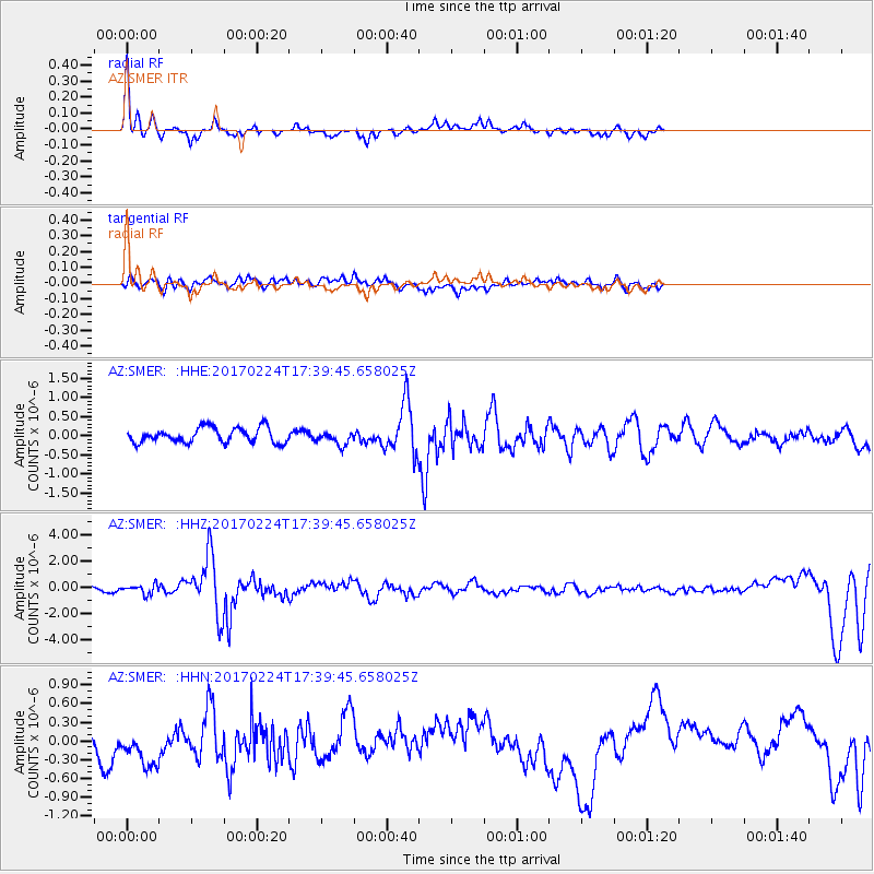
Signal To Noise
| Channel | StoN | STA | LTA |
| AZ:SMER: :HHZ:20170224T17:39:45.658025Z | 3.004507 | 3.6367416E-7 | 1.2104287E-7 |
| AZ:SMER: :HHN:20170224T17:39:45.658025Z | 1.2967893 | 3.6576378E-7 | 2.8205335E-7 |
| AZ:SMER: :HHE:20170224T17:39:45.658025Z | 0.9337336 | 1.8200296E-7 | 1.9491958E-7 |
| Arrivals |
| Ps | |
| PpPs | |
| PsPs/PpSs | |


