You are here: Home > Network List > CI - Caltech Regional Seismic Network Stations List
> Station MPP McPhearson Peak > Earthquake Result Viewer
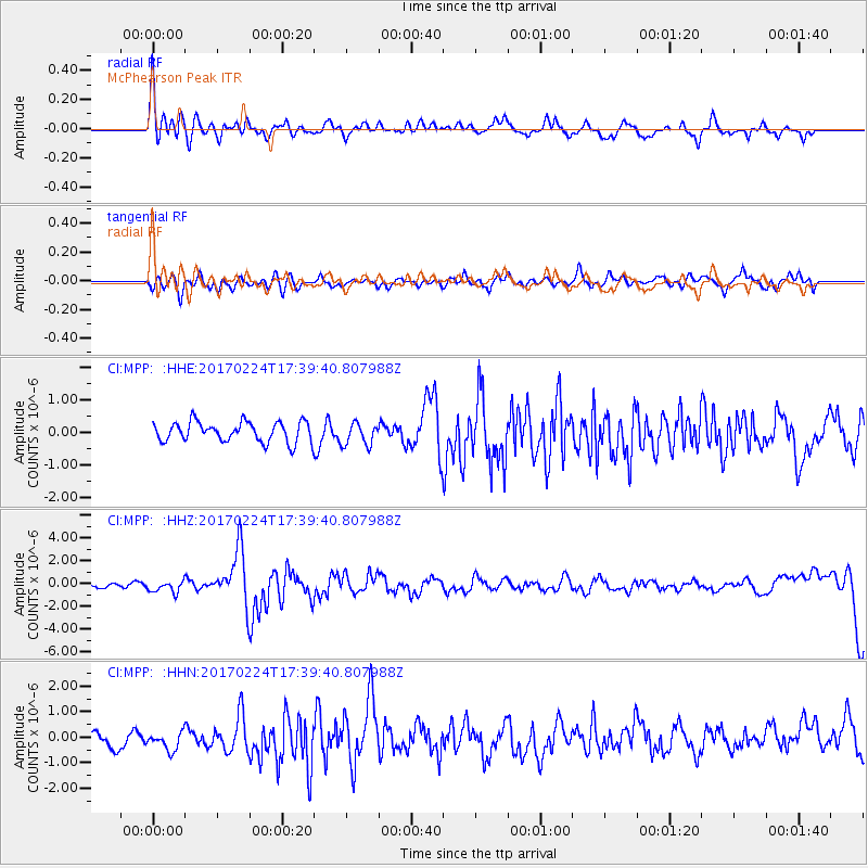
MPP McPhearson Peak - Earthquake Result Viewer
*The percent match for this event was below the threshold and hence no stack was calculated.
| Earthquake location: |
South Of Fiji Islands |
| Earthquake latitude/longitude: |
-23.2/-178.8 |
| Earthquake time(UTC): |
2017/02/24 (055) 17:28:44 GMT |
| Earthquake Depth: |
415 km |
| Earthquake Magnitude: |
6.9 mww |
| Earthquake Catalog/Contributor: |
NEIC PDE/us |
|
| Network: |
CI Caltech Regional Seismic Network |
| Station: |
MPP McPhearson Peak |
| Lat/Lon: |
34.89 N/119.81 W |
| Elevation: |
1739 m |
|
| Distance: |
80.5 deg |
| Az: |
45.617 deg |
| Baz: |
233.096 deg |
| Ray Param: |
$rayparam |
*The percent match for this event was below the threshold and hence was not used in the summary stack. |
|
| Radial Match: |
69.67266 % |
| Radial Bump: |
400 |
| Transverse Match: |
51.803627 % |
| Transverse Bump: |
400 |
| SOD ConfigId: |
11737051 |
| Insert Time: |
2019-04-26 19:56:03.117 +0000 |
| GWidth: |
2.5 |
| Max Bumps: |
400 |
| Tol: |
0.001 |
|
Signal To Noise
| Channel | StoN | STA | LTA |
| CI:MPP: :HHZ:20170224T17:39:40.807988Z | 1.7837824 | 4.72373E-7 | 2.6481536E-7 |
| CI:MPP: :HHN:20170224T17:39:40.807988Z | 1.206024 | 4.023447E-7 | 3.336125E-7 |
| CI:MPP: :HHE:20170224T17:39:40.807988Z | 1.1195128 | 3.4455817E-7 | 3.077751E-7 |
| Arrivals |
| Ps | |
| PpPs | |
| PsPs/PpSs | |


