You are here: Home > Network List > TA - USArray Transportable Network (new EarthScope stations) Stations List
> Station L20K Farewell, AK, USA > Earthquake Result Viewer
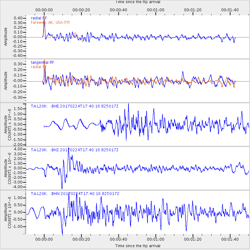
L20K Farewell, AK, USA - Earthquake Result Viewer
*The percent match for this event was below the threshold and hence no stack was calculated.
| Earthquake location: |
South Of Fiji Islands |
| Earthquake latitude/longitude: |
-23.2/-178.8 |
| Earthquake time(UTC): |
2017/02/24 (055) 17:28:44 GMT |
| Earthquake Depth: |
415 km |
| Earthquake Magnitude: |
6.9 mww |
| Earthquake Catalog/Contributor: |
NEIC PDE/us |
|
| Network: |
TA USArray Transportable Network (new EarthScope stations) |
| Station: |
L20K Farewell, AK, USA |
| Lat/Lon: |
62.48 N/153.88 W |
| Elevation: |
673 m |
|
| Distance: |
87.7 deg |
| Az: |
11.311 deg |
| Baz: |
202.853 deg |
| Ray Param: |
$rayparam |
*The percent match for this event was below the threshold and hence was not used in the summary stack. |
|
| Radial Match: |
74.71534 % |
| Radial Bump: |
400 |
| Transverse Match: |
63.334488 % |
| Transverse Bump: |
400 |
| SOD ConfigId: |
11737051 |
| Insert Time: |
2019-04-26 19:59:17.294 +0000 |
| GWidth: |
2.5 |
| Max Bumps: |
400 |
| Tol: |
0.001 |
|
Signal To Noise
| Channel | StoN | STA | LTA |
| TA:L20K: :BHZ:20170224T17:40:16.825017Z | 2.7799153 | 6.8040214E-7 | 2.4475642E-7 |
| TA:L20K: :BHN:20170224T17:40:16.825017Z | 1.3586751 | 2.66176E-7 | 1.959085E-7 |
| TA:L20K: :BHE:20170224T17:40:16.825017Z | 1.1343077 | 3.062736E-7 | 2.7000925E-7 |
| Arrivals |
| Ps | |
| PpPs | |
| PsPs/PpSs | |


