You are here: Home > Network List > TA - USArray Transportable Network (new EarthScope stations) Stations List
> Station N23A Red Feather Lakes, CO, USA > Earthquake Result Viewer
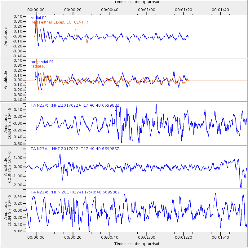
N23A Red Feather Lakes, CO, USA - Earthquake Result Viewer
*The percent match for this event was below the threshold and hence no stack was calculated.
| Earthquake location: |
South Of Fiji Islands |
| Earthquake latitude/longitude: |
-23.2/-178.8 |
| Earthquake time(UTC): |
2017/02/24 (055) 17:28:44 GMT |
| Earthquake Depth: |
415 km |
| Earthquake Magnitude: |
6.9 mww |
| Earthquake Catalog/Contributor: |
NEIC PDE/us |
|
| Network: |
TA USArray Transportable Network (new EarthScope stations) |
| Station: |
N23A Red Feather Lakes, CO, USA |
| Lat/Lon: |
40.89 N/105.94 W |
| Elevation: |
2458 m |
|
| Distance: |
92.9 deg |
| Az: |
46.508 deg |
| Baz: |
241.668 deg |
| Ray Param: |
$rayparam |
*The percent match for this event was below the threshold and hence was not used in the summary stack. |
|
| Radial Match: |
74.2771 % |
| Radial Bump: |
400 |
| Transverse Match: |
61.30203 % |
| Transverse Bump: |
400 |
| SOD ConfigId: |
11737051 |
| Insert Time: |
2019-04-26 19:59:26.729 +0000 |
| GWidth: |
2.5 |
| Max Bumps: |
400 |
| Tol: |
0.001 |
|
Signal To Noise
| Channel | StoN | STA | LTA |
| TA:N23A: :HHZ:20170224T17:40:40.669988Z | 2.4326909 | 2.3310545E-7 | 9.582206E-8 |
| TA:N23A: :HHN:20170224T17:40:40.669988Z | 2.4837449 | 2.4335E-7 | 9.797706E-8 |
| TA:N23A: :HHE:20170224T17:40:40.669988Z | 1.3984414 | 1.63833E-7 | 1.17153995E-7 |
| Arrivals |
| Ps | |
| PpPs | |
| PsPs/PpSs | |


