You are here: Home > Network List > US - United States National Seismic Network Stations List
> Station AMTX Amarillo, Texas, USA > Earthquake Result Viewer
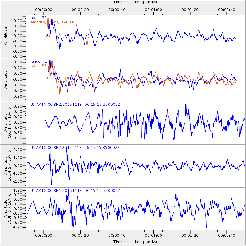
AMTX Amarillo, Texas, USA - Earthquake Result Viewer
*The percent match for this event was below the threshold and hence no stack was calculated.
| Earthquake location: |
Santiago Del Estero Prov., Arg. |
| Earthquake latitude/longitude: |
-29.9/-64.5 |
| Earthquake time(UTC): |
2015/11/13 (317) 06:04:15 GMT |
| Earthquake Depth: |
11 km |
| Earthquake Magnitude: |
5.8 MWP |
| Earthquake Catalog/Contributor: |
NEIC PDE/NEIC COMCAT |
|
| Network: |
US United States National Seismic Network |
| Station: |
AMTX Amarillo, Texas, USA |
| Lat/Lon: |
34.53 N/101.41 W |
| Elevation: |
1010 m |
|
| Distance: |
72.9 deg |
| Az: |
328.754 deg |
| Baz: |
146.924 deg |
| Ray Param: |
$rayparam |
*The percent match for this event was below the threshold and hence was not used in the summary stack. |
|
| Radial Match: |
61.123363 % |
| Radial Bump: |
400 |
| Transverse Match: |
66.19653 % |
| Transverse Bump: |
400 |
| SOD ConfigId: |
1259291 |
| Insert Time: |
2015-11-27 06:29:59.517 +0000 |
| GWidth: |
2.5 |
| Max Bumps: |
400 |
| Tol: |
0.001 |
|
Signal To Noise
| Channel | StoN | STA | LTA |
| US:AMTX:00:BHZ:20151113T06:15:15.350002Z | 3.211882 | 9.856899E-7 | 3.0688858E-7 |
| US:AMTX:00:BH1:20151113T06:15:15.350002Z | 0.9480457 | 3.1598574E-7 | 3.333022E-7 |
| US:AMTX:00:BH2:20151113T06:15:15.350002Z | 1.7615672 | 3.768854E-7 | 2.1394891E-7 |
| Arrivals |
| Ps | |
| PpPs | |
| PsPs/PpSs | |


