You are here: Home > Network List > CI - Caltech Regional Seismic Network Stations List
> Station MPM Manuel Prospect Mine, California, USA > Earthquake Result Viewer
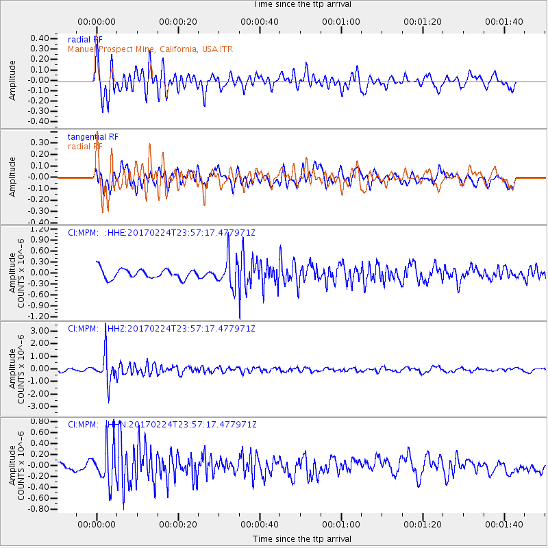
MPM Manuel Prospect Mine, California, USA - Earthquake Result Viewer
*The percent match for this event was below the threshold and hence no stack was calculated.
| Earthquake location: |
Fiji Islands Region |
| Earthquake latitude/longitude: |
-18.0/-178.5 |
| Earthquake time(UTC): |
2017/02/24 (055) 23:46:45 GMT |
| Earthquake Depth: |
581 km |
| Earthquake Magnitude: |
5.9 Mww |
| Earthquake Catalog/Contributor: |
NEIC PDE/us |
|
| Network: |
CI Caltech Regional Seismic Network |
| Station: |
MPM Manuel Prospect Mine, California, USA |
| Lat/Lon: |
36.06 N/117.49 W |
| Elevation: |
185 m |
|
| Distance: |
78.8 deg |
| Az: |
46.242 deg |
| Baz: |
238.042 deg |
| Ray Param: |
$rayparam |
*The percent match for this event was below the threshold and hence was not used in the summary stack. |
|
| Radial Match: |
75.43499 % |
| Radial Bump: |
400 |
| Transverse Match: |
45.880634 % |
| Transverse Bump: |
400 |
| SOD ConfigId: |
11737051 |
| Insert Time: |
2019-04-26 20:06:10.371 +0000 |
| GWidth: |
2.5 |
| Max Bumps: |
400 |
| Tol: |
0.001 |
|
Signal To Noise
| Channel | StoN | STA | LTA |
| CI:MPM: :HHZ:20170224T23:57:17.477971Z | 9.43676 | 1.1347496E-6 | 1.202478E-7 |
| CI:MPM: :HHN:20170224T23:57:17.477971Z | 3.5969641 | 3.378405E-7 | 9.392379E-8 |
| CI:MPM: :HHE:20170224T23:57:17.477971Z | 3.1177745 | 4.007998E-7 | 1.2855318E-7 |
| Arrivals |
| Ps | |
| PpPs | |
| PsPs/PpSs | |


