You are here: Home > Network List > CI - Caltech Regional Seismic Network Stations List
> Station MPP McPhearson Peak > Earthquake Result Viewer
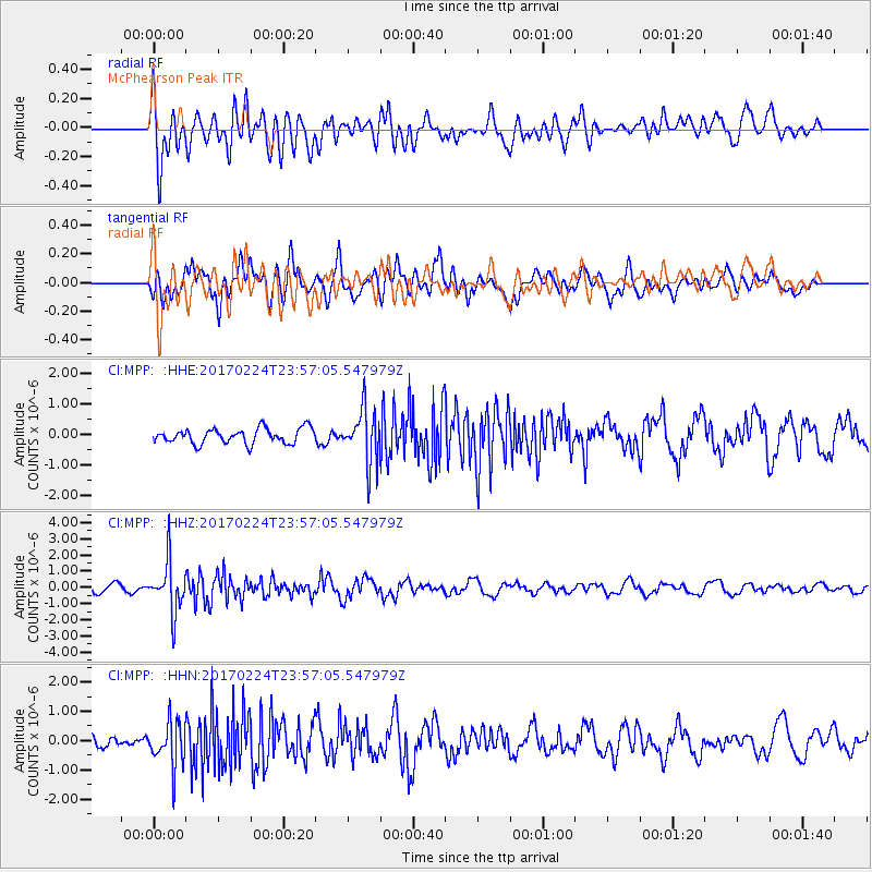
MPP McPhearson Peak - Earthquake Result Viewer
*The percent match for this event was below the threshold and hence no stack was calculated.
| Earthquake location: |
Fiji Islands Region |
| Earthquake latitude/longitude: |
-18.0/-178.5 |
| Earthquake time(UTC): |
2017/02/24 (055) 23:46:45 GMT |
| Earthquake Depth: |
581 km |
| Earthquake Magnitude: |
5.9 Mww |
| Earthquake Catalog/Contributor: |
NEIC PDE/us |
|
| Network: |
CI Caltech Regional Seismic Network |
| Station: |
MPP McPhearson Peak |
| Lat/Lon: |
34.89 N/119.81 W |
| Elevation: |
1739 m |
|
| Distance: |
76.5 deg |
| Az: |
46.201 deg |
| Baz: |
236.69 deg |
| Ray Param: |
$rayparam |
*The percent match for this event was below the threshold and hence was not used in the summary stack. |
|
| Radial Match: |
73.485214 % |
| Radial Bump: |
400 |
| Transverse Match: |
75.321075 % |
| Transverse Bump: |
400 |
| SOD ConfigId: |
11737051 |
| Insert Time: |
2019-04-26 20:06:10.520 +0000 |
| GWidth: |
2.5 |
| Max Bumps: |
400 |
| Tol: |
0.001 |
|
Signal To Noise
| Channel | StoN | STA | LTA |
| CI:MPP: :HHZ:20170224T23:57:05.547979Z | 6.8505363 | 1.5792978E-6 | 2.3053637E-7 |
| CI:MPP: :HHN:20170224T23:57:05.547979Z | 3.5648618 | 7.5568664E-7 | 2.1198203E-7 |
| CI:MPP: :HHE:20170224T23:57:05.547979Z | 3.5312076 | 8.61864E-7 | 2.440706E-7 |
| Arrivals |
| Ps | |
| PpPs | |
| PsPs/PpSs | |


