You are here: Home > Network List > CI - Caltech Regional Seismic Network Stations List
> Station SWS Sam W. Stewart, Westmorland, CA, USA > Earthquake Result Viewer
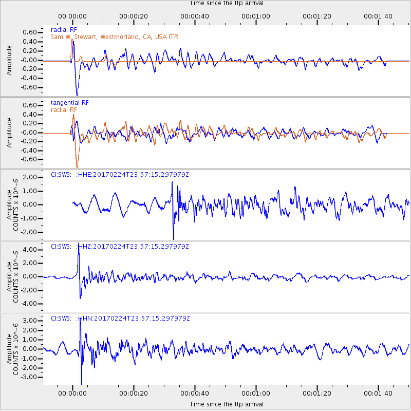
SWS Sam W. Stewart, Westmorland, CA, USA - Earthquake Result Viewer
*The percent match for this event was below the threshold and hence no stack was calculated.
| Earthquake location: |
Fiji Islands Region |
| Earthquake latitude/longitude: |
-18.0/-178.5 |
| Earthquake time(UTC): |
2017/02/24 (055) 23:46:45 GMT |
| Earthquake Depth: |
581 km |
| Earthquake Magnitude: |
5.9 Mww |
| Earthquake Catalog/Contributor: |
NEIC PDE/us |
|
| Network: |
CI Caltech Regional Seismic Network |
| Station: |
SWS Sam W. Stewart, Westmorland, CA, USA |
| Lat/Lon: |
32.94 N/115.80 W |
| Elevation: |
140 m |
|
| Distance: |
78.4 deg |
| Az: |
49.696 deg |
| Baz: |
239.681 deg |
| Ray Param: |
$rayparam |
*The percent match for this event was below the threshold and hence was not used in the summary stack. |
|
| Radial Match: |
74.90355 % |
| Radial Bump: |
400 |
| Transverse Match: |
69.8669 % |
| Transverse Bump: |
400 |
| SOD ConfigId: |
11737051 |
| Insert Time: |
2019-04-26 20:06:27.962 +0000 |
| GWidth: |
2.5 |
| Max Bumps: |
400 |
| Tol: |
0.001 |
|
Signal To Noise
| Channel | StoN | STA | LTA |
| CI:SWS: :HHZ:20170224T23:57:15.297979Z | 6.0872426 | 1.6015031E-6 | 2.6309172E-7 |
| CI:SWS: :HHN:20170224T23:57:15.297979Z | 3.8216076 | 1.1800313E-6 | 3.0877877E-7 |
| CI:SWS: :HHE:20170224T23:57:15.297979Z | 1.9772452 | 7.7938125E-7 | 3.9417532E-7 |
| Arrivals |
| Ps | |
| PpPs | |
| PsPs/PpSs | |


