You are here: Home > Network List > CN - Canadian National Seismograph Network Stations List
> Station INK INUVIK, NT > Earthquake Result Viewer
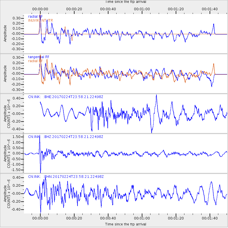
INK INUVIK, NT - Earthquake Result Viewer
*The percent match for this event was below the threshold and hence no stack was calculated.
| Earthquake location: |
Fiji Islands Region |
| Earthquake latitude/longitude: |
-18.0/-178.5 |
| Earthquake time(UTC): |
2017/02/24 (055) 23:46:45 GMT |
| Earthquake Depth: |
581 km |
| Earthquake Magnitude: |
5.9 Mww |
| Earthquake Catalog/Contributor: |
NEIC PDE/us |
|
| Network: |
CN Canadian National Seismograph Network |
| Station: |
INK INUVIK, NT |
| Lat/Lon: |
68.31 N/133.53 W |
| Elevation: |
44 m |
|
| Distance: |
92.0 deg |
| Az: |
15.231 deg |
| Baz: |
222.267 deg |
| Ray Param: |
$rayparam |
*The percent match for this event was below the threshold and hence was not used in the summary stack. |
|
| Radial Match: |
62.87821 % |
| Radial Bump: |
400 |
| Transverse Match: |
52.73493 % |
| Transverse Bump: |
400 |
| SOD ConfigId: |
11737051 |
| Insert Time: |
2019-04-26 20:06:50.149 +0000 |
| GWidth: |
2.5 |
| Max Bumps: |
400 |
| Tol: |
0.001 |
|
Signal To Noise
| Channel | StoN | STA | LTA |
| CN:INK: :BHZ:20170224T23:58:21.22498Z | 5.293975 | 6.2690344E-7 | 1.18418285E-7 |
| CN:INK: :BHN:20170224T23:58:21.22498Z | 2.2627616 | 2.297032E-7 | 1.01514544E-7 |
| CN:INK: :BHE:20170224T23:58:21.22498Z | 1.8729651 | 1.9653702E-7 | 1.04933626E-7 |
| Arrivals |
| Ps | |
| PpPs | |
| PsPs/PpSs | |


