You are here: Home > Network List > TA - USArray Transportable Network (new EarthScope stations) Stations List
> Station D25K Kavik River, AK, USA > Earthquake Result Viewer
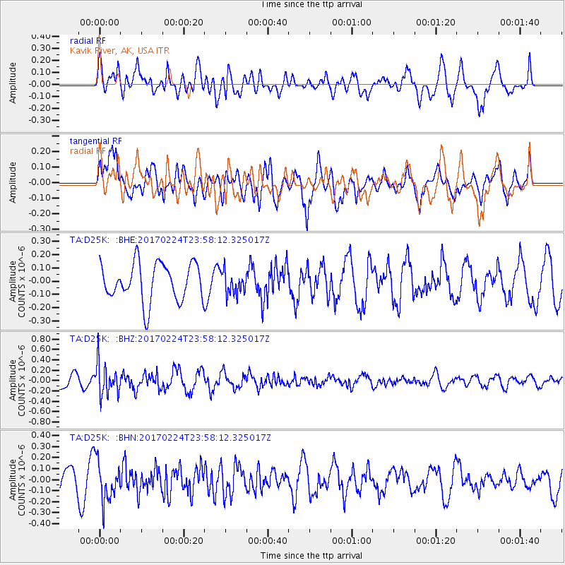
D25K Kavik River, AK, USA - Earthquake Result Viewer
*The percent match for this event was below the threshold and hence no stack was calculated.
| Earthquake location: |
Fiji Islands Region |
| Earthquake latitude/longitude: |
-18.0/-178.5 |
| Earthquake time(UTC): |
2017/02/24 (055) 23:46:45 GMT |
| Earthquake Depth: |
581 km |
| Earthquake Magnitude: |
5.9 Mww |
| Earthquake Catalog/Contributor: |
NEIC PDE/us |
|
| Network: |
TA USArray Transportable Network (new EarthScope stations) |
| Station: |
D25K Kavik River, AK, USA |
| Lat/Lon: |
69.32 N/146.38 W |
| Elevation: |
770 m |
|
| Distance: |
90.0 deg |
| Az: |
10.873 deg |
| Baz: |
210.364 deg |
| Ray Param: |
$rayparam |
*The percent match for this event was below the threshold and hence was not used in the summary stack. |
|
| Radial Match: |
61.175068 % |
| Radial Bump: |
400 |
| Transverse Match: |
62.75808 % |
| Transverse Bump: |
400 |
| SOD ConfigId: |
11737051 |
| Insert Time: |
2019-04-26 20:10:44.636 +0000 |
| GWidth: |
2.5 |
| Max Bumps: |
400 |
| Tol: |
0.001 |
|
Signal To Noise
| Channel | StoN | STA | LTA |
| TA:D25K: :BHZ:20170224T23:58:12.325017Z | 2.1401944 | 3.0817952E-7 | 1.4399603E-7 |
| TA:D25K: :BHN:20170224T23:58:12.325017Z | 1.6717386 | 1.6946103E-7 | 1.0136814E-7 |
| TA:D25K: :BHE:20170224T23:58:12.325017Z | 0.5990614 | 8.537424E-8 | 1.4251333E-7 |
| Arrivals |
| Ps | |
| PpPs | |
| PsPs/PpSs | |


