You are here: Home > Network List > TA - USArray Transportable Network (new EarthScope stations) Stations List
> Station J26L Joseph Creek, AK, USA > Earthquake Result Viewer
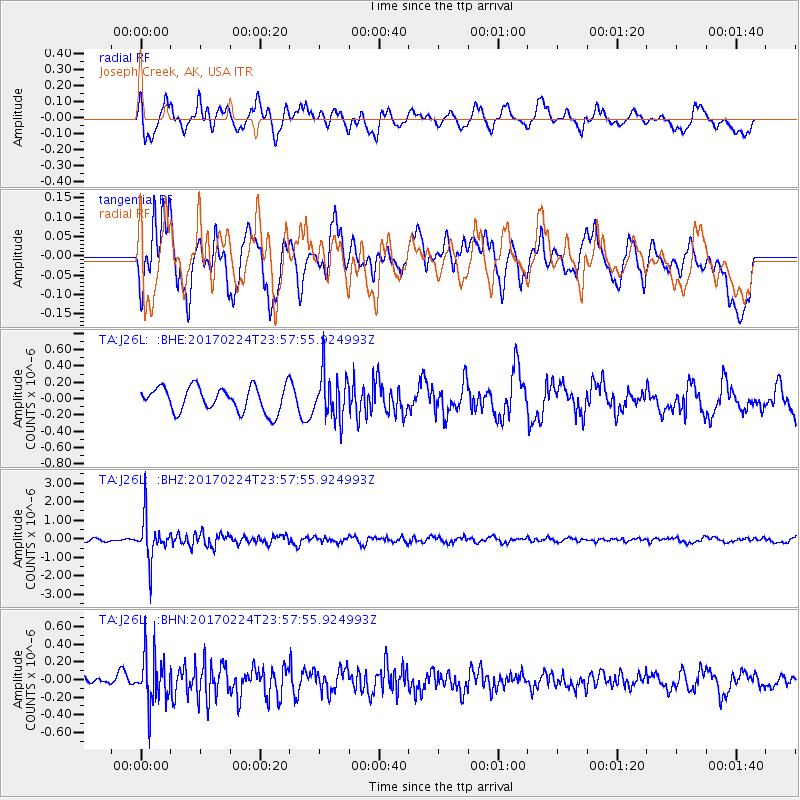
J26L Joseph Creek, AK, USA - Earthquake Result Viewer
*The percent match for this event was below the threshold and hence no stack was calculated.
| Earthquake location: |
Fiji Islands Region |
| Earthquake latitude/longitude: |
-18.0/-178.5 |
| Earthquake time(UTC): |
2017/02/24 (055) 23:46:45 GMT |
| Earthquake Depth: |
581 km |
| Earthquake Magnitude: |
5.9 Mww |
| Earthquake Catalog/Contributor: |
NEIC PDE/us |
|
| Network: |
TA USArray Transportable Network (new EarthScope stations) |
| Station: |
J26L Joseph Creek, AK, USA |
| Lat/Lon: |
64.50 N/143.56 W |
| Elevation: |
1144 m |
|
| Distance: |
86.5 deg |
| Az: |
14.363 deg |
| Baz: |
213.058 deg |
| Ray Param: |
$rayparam |
*The percent match for this event was below the threshold and hence was not used in the summary stack. |
|
| Radial Match: |
52.657127 % |
| Radial Bump: |
400 |
| Transverse Match: |
40.97239 % |
| Transverse Bump: |
400 |
| SOD ConfigId: |
11737051 |
| Insert Time: |
2019-04-26 20:11:06.112 +0000 |
| GWidth: |
2.5 |
| Max Bumps: |
400 |
| Tol: |
0.001 |
|
Signal To Noise
| Channel | StoN | STA | LTA |
| TA:J26L: :BHZ:20170224T23:57:55.924993Z | 10.1463585 | 1.1255592E-6 | 1.1093232E-7 |
| TA:J26L: :BHN:20170224T23:57:55.924993Z | 1.8641207 | 2.741675E-7 | 1.4707605E-7 |
| TA:J26L: :BHE:20170224T23:57:55.924993Z | 1.8232511 | 2.7746773E-7 | 1.5218293E-7 |
| Arrivals |
| Ps | |
| PpPs | |
| PsPs/PpSs | |


