You are here: Home > Network List > CI - Caltech Regional Seismic Network Stations List
> Station RCT Rector, Visalia, CA, USA > Earthquake Result Viewer
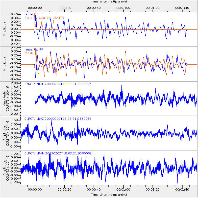
RCT Rector, Visalia, CA, USA - Earthquake Result Viewer
*The percent match for this event was below the threshold and hence no stack was calculated.
| Earthquake location: |
Near Coast Of Peru |
| Earthquake latitude/longitude: |
-13.6/-76.6 |
| Earthquake time(UTC): |
2009/02/02 (033) 17:53:21 GMT |
| Earthquake Depth: |
21 km |
| Earthquake Magnitude: |
5.6 MB, 5.6 MS, 6.0 MW, 5.9 MW |
| Earthquake Catalog/Contributor: |
WHDF/NEIC |
|
| Network: |
CI Caltech Regional Seismic Network |
| Station: |
RCT Rector, Visalia, CA, USA |
| Lat/Lon: |
36.31 N/119.24 W |
| Elevation: |
107 m |
|
| Distance: |
63.9 deg |
| Az: |
322.425 deg |
| Baz: |
132.771 deg |
| Ray Param: |
$rayparam |
*The percent match for this event was below the threshold and hence was not used in the summary stack. |
|
| Radial Match: |
59.181488 % |
| Radial Bump: |
400 |
| Transverse Match: |
76.071495 % |
| Transverse Bump: |
400 |
| SOD ConfigId: |
6627 |
| Insert Time: |
2010-03-05 22:14:18.789 +0000 |
| GWidth: |
2.5 |
| Max Bumps: |
400 |
| Tol: |
0.001 |
|
Signal To Noise
| Channel | StoN | STA | LTA |
| CI:RCT: :BHZ:20090202T18:03:21.956006Z | 1.9494905 | 5.470638E-7 | 2.8061885E-7 |
| CI:RCT: :BHN:20090202T18:03:21.956006Z | 1.3230116 | 3.832682E-7 | 2.8969376E-7 |
| CI:RCT: :BHE:20090202T18:03:21.956006Z | 0.9380449 | 3.1122943E-7 | 3.317852E-7 |
| Arrivals |
| Ps | |
| PpPs | |
| PsPs/PpSs | |


