You are here: Home > Network List > TA - USArray Transportable Network (new EarthScope stations) Stations List
> Station MDND Maddock, ND, USA > Earthquake Result Viewer
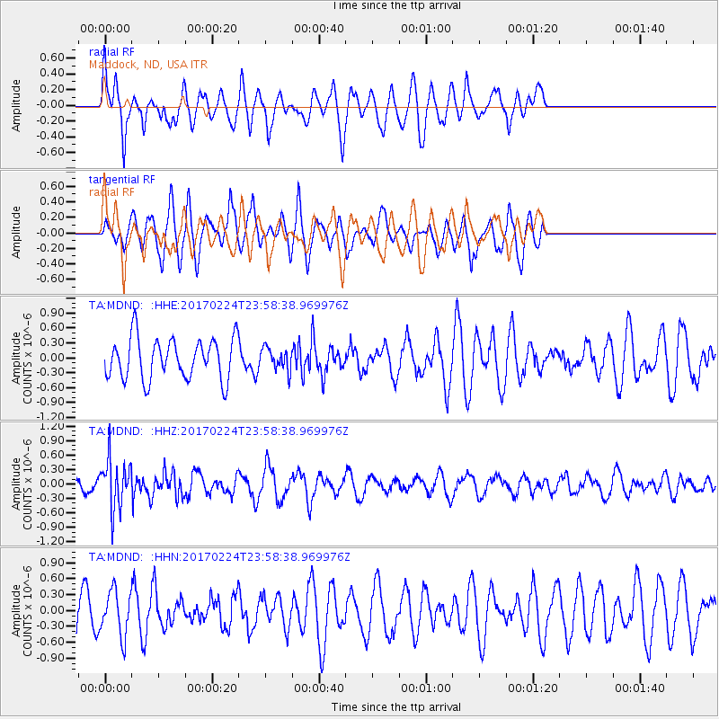
MDND Maddock, ND, USA - Earthquake Result Viewer
*The percent match for this event was below the threshold and hence no stack was calculated.
| Earthquake location: |
Fiji Islands Region |
| Earthquake latitude/longitude: |
-18.0/-178.5 |
| Earthquake time(UTC): |
2017/02/24 (055) 23:46:45 GMT |
| Earthquake Depth: |
581 km |
| Earthquake Magnitude: |
5.9 Mww |
| Earthquake Catalog/Contributor: |
NEIC PDE/us |
|
| Network: |
TA USArray Transportable Network (new EarthScope stations) |
| Station: |
MDND Maddock, ND, USA |
| Lat/Lon: |
47.85 N/99.60 W |
| Elevation: |
479 m |
|
| Distance: |
95.9 deg |
| Az: |
41.634 deg |
| Baz: |
249.856 deg |
| Ray Param: |
$rayparam |
*The percent match for this event was below the threshold and hence was not used in the summary stack. |
|
| Radial Match: |
71.28298 % |
| Radial Bump: |
400 |
| Transverse Match: |
54.6471 % |
| Transverse Bump: |
384 |
| SOD ConfigId: |
11737051 |
| Insert Time: |
2019-04-26 20:11:22.798 +0000 |
| GWidth: |
2.5 |
| Max Bumps: |
400 |
| Tol: |
0.001 |
|
Signal To Noise
| Channel | StoN | STA | LTA |
| TA:MDND: :HHZ:20170224T23:58:38.969976Z | 3.1556852 | 5.0238634E-7 | 1.592004E-7 |
| TA:MDND: :HHN:20170224T23:58:38.969976Z | 0.8514073 | 4.2413154E-7 | 4.9815355E-7 |
| TA:MDND: :HHE:20170224T23:58:38.969976Z | 0.54052466 | 2.2190835E-7 | 4.1054253E-7 |
| Arrivals |
| Ps | |
| PpPs | |
| PsPs/PpSs | |


