You are here: Home > Network List > CI - Caltech Regional Seismic Network Stations List
> Station RCT Rector, Visalia, CA, USA > Earthquake Result Viewer
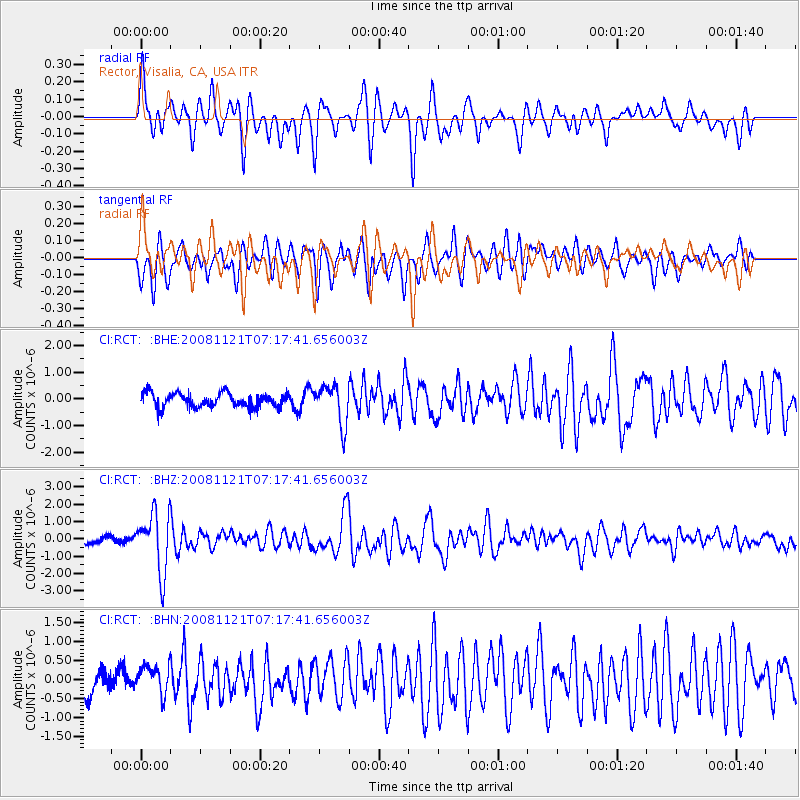
RCT Rector, Visalia, CA, USA - Earthquake Result Viewer
*The percent match for this event was below the threshold and hence no stack was calculated.
| Earthquake location: |
Solomon Islands |
| Earthquake latitude/longitude: |
-8.9/159.6 |
| Earthquake time(UTC): |
2008/11/21 (326) 07:05:34 GMT |
| Earthquake Depth: |
118 km |
| Earthquake Magnitude: |
6.0 MB, 6.1 MW, 6.0 MW |
| Earthquake Catalog/Contributor: |
WHDF/NEIC |
|
| Network: |
CI Caltech Regional Seismic Network |
| Station: |
RCT Rector, Visalia, CA, USA |
| Lat/Lon: |
36.31 N/119.24 W |
| Elevation: |
107 m |
|
| Distance: |
88.2 deg |
| Az: |
53.001 deg |
| Baz: |
257.644 deg |
| Ray Param: |
$rayparam |
*The percent match for this event was below the threshold and hence was not used in the summary stack. |
|
| Radial Match: |
68.16435 % |
| Radial Bump: |
400 |
| Transverse Match: |
70.66055 % |
| Transverse Bump: |
400 |
| SOD ConfigId: |
2658 |
| Insert Time: |
2010-03-05 22:14:21.667 +0000 |
| GWidth: |
2.5 |
| Max Bumps: |
400 |
| Tol: |
0.001 |
|
Signal To Noise
| Channel | StoN | STA | LTA |
| CI:RCT: :BHZ:20081121T07:17:41.656003Z | 7.2971506 | 1.7128172E-6 | 2.347241E-7 |
| CI:RCT: :BHN:20081121T07:17:41.656003Z | 1.3890786 | 3.7804847E-7 | 2.7215773E-7 |
| CI:RCT: :BHE:20081121T07:17:41.656003Z | 2.7985337 | 7.333878E-7 | 2.6206146E-7 |
| Arrivals |
| Ps | |
| PpPs | |
| PsPs/PpSs | |


