You are here: Home > Network List > TA - USArray Transportable Network (new EarthScope stations) Stations List
> Station R11A Troy Canyon, Currant, NV, USA > Earthquake Result Viewer
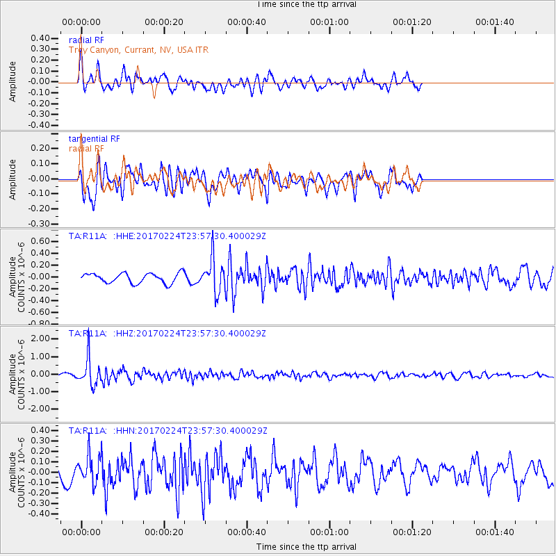
R11A Troy Canyon, Currant, NV, USA - Earthquake Result Viewer
*The percent match for this event was below the threshold and hence no stack was calculated.
| Earthquake location: |
Fiji Islands Region |
| Earthquake latitude/longitude: |
-18.0/-178.5 |
| Earthquake time(UTC): |
2017/02/24 (055) 23:46:45 GMT |
| Earthquake Depth: |
581 km |
| Earthquake Magnitude: |
5.9 Mww |
| Earthquake Catalog/Contributor: |
NEIC PDE/us |
|
| Network: |
TA USArray Transportable Network (new EarthScope stations) |
| Station: |
R11A Troy Canyon, Currant, NV, USA |
| Lat/Lon: |
38.35 N/115.59 W |
| Elevation: |
1756 m |
|
| Distance: |
81.3 deg |
| Az: |
45.069 deg |
| Baz: |
238.985 deg |
| Ray Param: |
$rayparam |
*The percent match for this event was below the threshold and hence was not used in the summary stack. |
|
| Radial Match: |
55.846443 % |
| Radial Bump: |
400 |
| Transverse Match: |
72.271515 % |
| Transverse Bump: |
400 |
| SOD ConfigId: |
11737051 |
| Insert Time: |
2019-04-26 20:11:49.195 +0000 |
| GWidth: |
2.5 |
| Max Bumps: |
400 |
| Tol: |
0.001 |
|
Signal To Noise
| Channel | StoN | STA | LTA |
| TA:R11A: :HHZ:20170224T23:57:30.400029Z | 6.232101 | 8.042478E-7 | 1.2904923E-7 |
| TA:R11A: :HHN:20170224T23:57:30.400029Z | 1.2254496 | 1.3539552E-7 | 1.1048641E-7 |
| TA:R11A: :HHE:20170224T23:57:30.400029Z | 3.4505923 | 2.8761173E-7 | 8.33514E-8 |
| Arrivals |
| Ps | |
| PpPs | |
| PsPs/PpSs | |


