You are here: Home > Network List > CI - Caltech Regional Seismic Network Stations List
> Station RCT Rector, Visalia, CA, USA > Earthquake Result Viewer
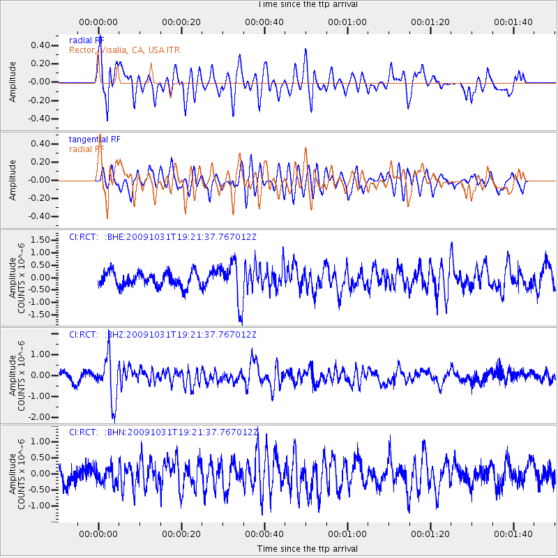
RCT Rector, Visalia, CA, USA - Earthquake Result Viewer
*The percent match for this event was below the threshold and hence no stack was calculated.
| Earthquake location: |
Santa Cruz Islands |
| Earthquake latitude/longitude: |
-11.4/166.4 |
| Earthquake time(UTC): |
2009/10/31 (304) 19:09:51 GMT |
| Earthquake Depth: |
134 km |
| Earthquake Magnitude: |
5.9 MB, 5.9 MW, 5.9 MW |
| Earthquake Catalog/Contributor: |
WHDF/NEIC |
|
| Network: |
CI Caltech Regional Seismic Network |
| Station: |
RCT Rector, Visalia, CA, USA |
| Lat/Lon: |
36.31 N/119.24 W |
| Elevation: |
107 m |
|
| Distance: |
84.4 deg |
| Az: |
51.414 deg |
| Baz: |
251.611 deg |
| Ray Param: |
$rayparam |
*The percent match for this event was below the threshold and hence was not used in the summary stack. |
|
| Radial Match: |
69.706 % |
| Radial Bump: |
400 |
| Transverse Match: |
69.41466 % |
| Transverse Bump: |
400 |
| SOD ConfigId: |
2622 |
| Insert Time: |
2010-03-05 22:14:34.426 +0000 |
| GWidth: |
2.5 |
| Max Bumps: |
400 |
| Tol: |
0.001 |
|
Signal To Noise
| Channel | StoN | STA | LTA |
| CI:RCT: :BHZ:20091031T19:21:37.767012Z | 4.612739 | 1.0688678E-6 | 2.3172088E-7 |
| CI:RCT: :BHN:20091031T19:21:37.767012Z | 0.81996816 | 2.5107371E-7 | 3.0619933E-7 |
| CI:RCT: :BHE:20091031T19:21:37.767012Z | 2.9965599 | 8.584473E-7 | 2.8647761E-7 |
| Arrivals |
| Ps | |
| PpPs | |
| PsPs/PpSs | |


