You are here: Home > Network List > TA - USArray Transportable Network (new EarthScope stations) Stations List
> Station V35K Ketchikan, AK, USA > Earthquake Result Viewer
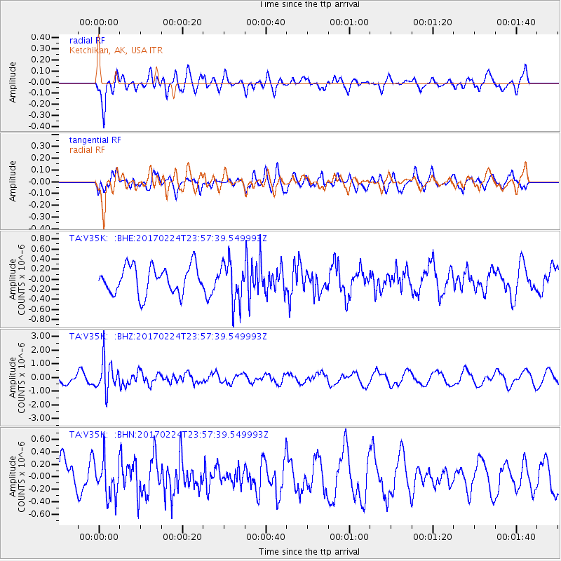
V35K Ketchikan, AK, USA - Earthquake Result Viewer
*The percent match for this event was below the threshold and hence no stack was calculated.
| Earthquake location: |
Fiji Islands Region |
| Earthquake latitude/longitude: |
-18.0/-178.5 |
| Earthquake time(UTC): |
2017/02/24 (055) 23:46:45 GMT |
| Earthquake Depth: |
581 km |
| Earthquake Magnitude: |
5.9 Mww |
| Earthquake Catalog/Contributor: |
NEIC PDE/us |
|
| Network: |
TA USArray Transportable Network (new EarthScope stations) |
| Station: |
V35K Ketchikan, AK, USA |
| Lat/Lon: |
55.33 N/131.62 W |
| Elevation: |
64 m |
|
| Distance: |
83.1 deg |
| Az: |
24.828 deg |
| Baz: |
224.378 deg |
| Ray Param: |
$rayparam |
*The percent match for this event was below the threshold and hence was not used in the summary stack. |
|
| Radial Match: |
75.98246 % |
| Radial Bump: |
400 |
| Transverse Match: |
51.16327 % |
| Transverse Bump: |
400 |
| SOD ConfigId: |
11737051 |
| Insert Time: |
2019-04-26 20:12:01.100 +0000 |
| GWidth: |
2.5 |
| Max Bumps: |
400 |
| Tol: |
0.001 |
|
Signal To Noise
| Channel | StoN | STA | LTA |
| TA:V35K: :BHZ:20170224T23:57:39.549993Z | 3.791469 | 1.1237084E-6 | 2.963781E-7 |
| TA:V35K: :BHN:20170224T23:57:39.549993Z | 1.2829901 | 2.9048866E-7 | 2.2641535E-7 |
| TA:V35K: :BHE:20170224T23:57:39.549993Z | 1.4999586 | 4.086975E-7 | 2.724725E-7 |
| Arrivals |
| Ps | |
| PpPs | |
| PsPs/PpSs | |


