You are here: Home > Network List > CI - Caltech Regional Seismic Network Stations List
> Station RCT Rector, Visalia, CA, USA > Earthquake Result Viewer
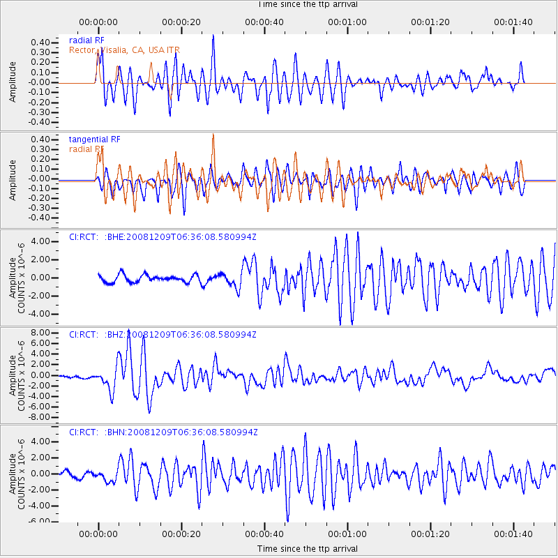
RCT Rector, Visalia, CA, USA - Earthquake Result Viewer
*The percent match for this event was below the threshold and hence no stack was calculated.
| Earthquake location: |
Kermadec Islands Region |
| Earthquake latitude/longitude: |
-31.2/-176.9 |
| Earthquake time(UTC): |
2008/12/09 (344) 06:23:59 GMT |
| Earthquake Depth: |
18 km |
| Earthquake Magnitude: |
6.2 MB, 6.7 MS, 6.8 MW, 6.7 MW |
| Earthquake Catalog/Contributor: |
WHDF/NEIC |
|
| Network: |
CI Caltech Regional Seismic Network |
| Station: |
RCT Rector, Visalia, CA, USA |
| Lat/Lon: |
36.31 N/119.24 W |
| Elevation: |
107 m |
|
| Distance: |
86.2 deg |
| Az: |
43.165 deg |
| Baz: |
226.508 deg |
| Ray Param: |
$rayparam |
*The percent match for this event was below the threshold and hence was not used in the summary stack. |
|
| Radial Match: |
87.824425 % |
| Radial Bump: |
400 |
| Transverse Match: |
83.65381 % |
| Transverse Bump: |
400 |
| SOD ConfigId: |
2658 |
| Insert Time: |
2010-03-05 22:14:40.174 +0000 |
| GWidth: |
2.5 |
| Max Bumps: |
400 |
| Tol: |
0.001 |
|
Signal To Noise
| Channel | StoN | STA | LTA |
| CI:RCT: :BHZ:20081209T06:36:08.580994Z | 11.189589 | 2.3179336E-6 | 2.0715092E-7 |
| CI:RCT: :BHN:20081209T06:36:08.580994Z | 2.4138534 | 7.120011E-7 | 2.9496454E-7 |
| CI:RCT: :BHE:20081209T06:36:08.580994Z | 2.147139 | 8.614555E-7 | 4.0121085E-7 |
| Arrivals |
| Ps | |
| PpPs | |
| PsPs/PpSs | |


