You are here: Home > Network List > UW - Pacific Northwest Regional Seismic Network Stations List
> Station FISH Seaside, OR, USA > Earthquake Result Viewer
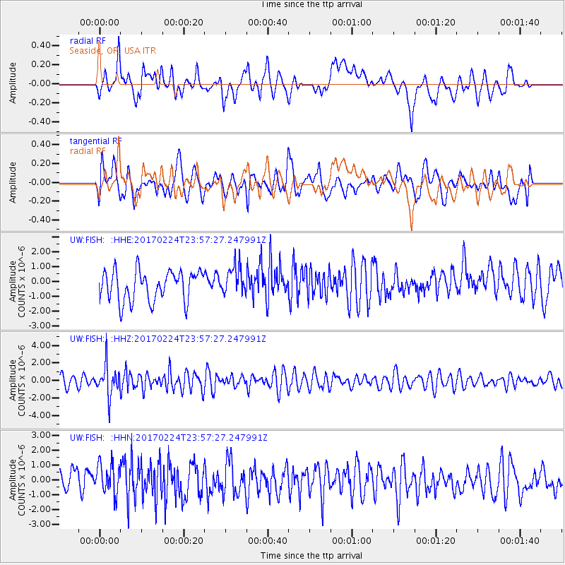
FISH Seaside, OR, USA - Earthquake Result Viewer
*The percent match for this event was below the threshold and hence no stack was calculated.
| Earthquake location: |
Fiji Islands Region |
| Earthquake latitude/longitude: |
-18.0/-178.5 |
| Earthquake time(UTC): |
2017/02/24 (055) 23:46:45 GMT |
| Earthquake Depth: |
581 km |
| Earthquake Magnitude: |
5.9 Mww |
| Earthquake Catalog/Contributor: |
NEIC PDE/us |
|
| Network: |
UW Pacific Northwest Regional Seismic Network |
| Station: |
FISH Seaside, OR, USA |
| Lat/Lon: |
45.93 N/123.56 W |
| Elevation: |
325 m |
|
| Distance: |
80.7 deg |
| Az: |
35.357 deg |
| Baz: |
232.108 deg |
| Ray Param: |
$rayparam |
*The percent match for this event was below the threshold and hence was not used in the summary stack. |
|
| Radial Match: |
48.2502 % |
| Radial Bump: |
400 |
| Transverse Match: |
48.411797 % |
| Transverse Bump: |
400 |
| SOD ConfigId: |
11737051 |
| Insert Time: |
2019-04-26 20:12:54.292 +0000 |
| GWidth: |
2.5 |
| Max Bumps: |
400 |
| Tol: |
0.001 |
|
Signal To Noise
| Channel | StoN | STA | LTA |
| UW:FISH: :HHZ:20170224T23:57:27.247991Z | 2.8735683 | 1.7997023E-6 | 6.262953E-7 |
| UW:FISH: :HHN:20170224T23:57:27.247991Z | 1.2111099 | 1.0996009E-6 | 9.0792827E-7 |
| UW:FISH: :HHE:20170224T23:57:27.247991Z | 0.9605688 | 9.744801E-7 | 1.0144825E-6 |
| Arrivals |
| Ps | |
| PpPs | |
| PsPs/PpSs | |


