You are here: Home > Network List > CI - Caltech Regional Seismic Network Stations List
> Station RCT Rector, Visalia, CA, USA > Earthquake Result Viewer
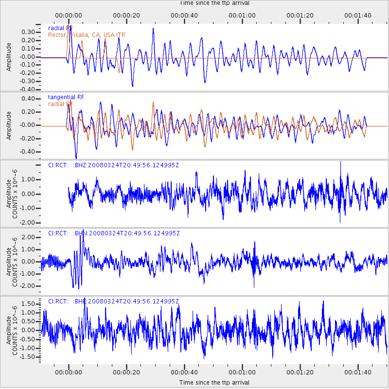
RCT Rector, Visalia, CA, USA - Earthquake Result Viewer
*The percent match for this event was below the threshold and hence no stack was calculated.
| Earthquake location: |
Chile-Bolivia Border Region |
| Earthquake latitude/longitude: |
-20.0/-69.0 |
| Earthquake time(UTC): |
2008/03/24 (084) 20:39:07 GMT |
| Earthquake Depth: |
120 km |
| Earthquake Magnitude: |
5.7 MB, 6.2 MW, 6.1 MW |
| Earthquake Catalog/Contributor: |
WHDF/NEIC |
|
| Network: |
CI Caltech Regional Seismic Network |
| Station: |
RCT Rector, Visalia, CA, USA |
| Lat/Lon: |
36.31 N/119.24 W |
| Elevation: |
107 m |
|
| Distance: |
73.5 deg |
| Az: |
319.602 deg |
| Baz: |
131.033 deg |
| Ray Param: |
$rayparam |
*The percent match for this event was below the threshold and hence was not used in the summary stack. |
|
| Radial Match: |
63.713547 % |
| Radial Bump: |
400 |
| Transverse Match: |
64.467064 % |
| Transverse Bump: |
400 |
| SOD ConfigId: |
2504 |
| Insert Time: |
2010-03-05 22:14:51.077 +0000 |
| GWidth: |
2.5 |
| Max Bumps: |
400 |
| Tol: |
0.001 |
|
Signal To Noise
| Channel | StoN | STA | LTA |
| CI:RCT: :BHN:20080324T20:49:56.124995Z | 3.1823833 | 1.1018983E-6 | 3.4624938E-7 |
| CI:RCT: :BHE:20080324T20:49:56.124995Z | 1.2887677 | 5.0533447E-7 | 3.921067E-7 |
| CI:RCT: :BHZ:20080324T20:49:56.124995Z | 0.79377913 | 3.3167387E-7 | 4.178415E-7 |
| Arrivals |
| Ps | |
| PpPs | |
| PsPs/PpSs | |


