You are here: Home > Network List > TA - USArray Transportable Network (new EarthScope stations) Stations List
> Station R32K Eaglecrest, AK, USA > Earthquake Result Viewer
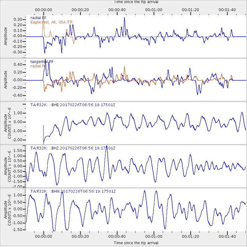
R32K Eaglecrest, AK, USA - Earthquake Result Viewer
*The percent match for this event was below the threshold and hence no stack was calculated.
| Earthquake location: |
Vanuatu Islands |
| Earthquake latitude/longitude: |
-18.5/169.4 |
| Earthquake time(UTC): |
2017/02/26 (057) 06:44:21 GMT |
| Earthquake Depth: |
244 km |
| Earthquake Magnitude: |
5.5 mb |
| Earthquake Catalog/Contributor: |
NEIC PDE/us |
|
| Network: |
TA USArray Transportable Network (new EarthScope stations) |
| Station: |
R32K Eaglecrest, AK, USA |
| Lat/Lon: |
58.27 N/134.52 W |
| Elevation: |
386 m |
|
| Distance: |
89.3 deg |
| Az: |
26.016 deg |
| Baz: |
231.964 deg |
| Ray Param: |
$rayparam |
*The percent match for this event was below the threshold and hence was not used in the summary stack. |
|
| Radial Match: |
53.9643 % |
| Radial Bump: |
400 |
| Transverse Match: |
34.475266 % |
| Transverse Bump: |
400 |
| SOD ConfigId: |
11737051 |
| Insert Time: |
2019-04-26 20:19:28.278 +0000 |
| GWidth: |
2.5 |
| Max Bumps: |
400 |
| Tol: |
0.001 |
|
Signal To Noise
| Channel | StoN | STA | LTA |
| TA:R32K: :BHZ:20170226T06:56:19.17501Z | 1.8171288 | 8.8243047E-7 | 4.85618E-7 |
| TA:R32K: :BHN:20170226T06:56:19.17501Z | 1.0537074 | 5.8363275E-7 | 5.5388506E-7 |
| TA:R32K: :BHE:20170226T06:56:19.17501Z | 1.2778158 | 8.6451666E-7 | 6.765581E-7 |
| Arrivals |
| Ps | |
| PpPs | |
| PsPs/PpSs | |


