You are here: Home > Network List > UW - Pacific Northwest Regional Seismic Network Stations List
> Station LEBA Lebam, WA, USA > Earthquake Result Viewer
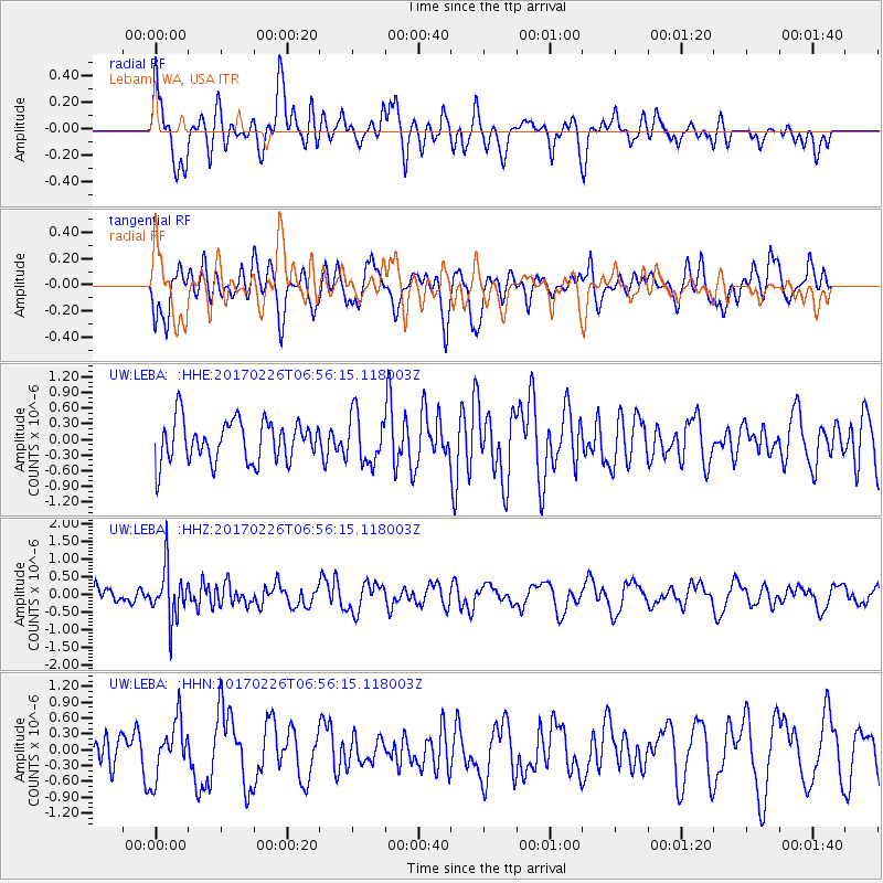
LEBA Lebam, WA, USA - Earthquake Result Viewer
*The percent match for this event was below the threshold and hence no stack was calculated.
| Earthquake location: |
Vanuatu Islands |
| Earthquake latitude/longitude: |
-18.5/169.4 |
| Earthquake time(UTC): |
2017/02/26 (057) 06:44:21 GMT |
| Earthquake Depth: |
244 km |
| Earthquake Magnitude: |
5.5 mb |
| Earthquake Catalog/Contributor: |
NEIC PDE/us |
|
| Network: |
UW Pacific Northwest Regional Seismic Network |
| Station: |
LEBA Lebam, WA, USA |
| Lat/Lon: |
46.55 N/123.56 W |
| Elevation: |
73 m |
|
| Distance: |
88.5 deg |
| Az: |
39.482 deg |
| Baz: |
240.938 deg |
| Ray Param: |
$rayparam |
*The percent match for this event was below the threshold and hence was not used in the summary stack. |
|
| Radial Match: |
53.245754 % |
| Radial Bump: |
400 |
| Transverse Match: |
54.351254 % |
| Transverse Bump: |
400 |
| SOD ConfigId: |
11737051 |
| Insert Time: |
2019-04-26 20:20:15.399 +0000 |
| GWidth: |
2.5 |
| Max Bumps: |
400 |
| Tol: |
0.001 |
|
Signal To Noise
| Channel | StoN | STA | LTA |
| UW:LEBA: :HHZ:20170226T06:56:15.118003Z | 3.1112518 | 7.30022E-7 | 2.3463932E-7 |
| UW:LEBA: :HHN:20170226T06:56:15.118003Z | 1.7430921 | 5.255003E-7 | 3.0147592E-7 |
| UW:LEBA: :HHE:20170226T06:56:15.118003Z | 1.187222 | 4.72673E-7 | 3.9813364E-7 |
| Arrivals |
| Ps | |
| PpPs | |
| PsPs/PpSs | |


