You are here: Home > Network List > US - United States National Seismic Network Stations List
> Station EYMN Ely, Minnesota, USA > Earthquake Result Viewer
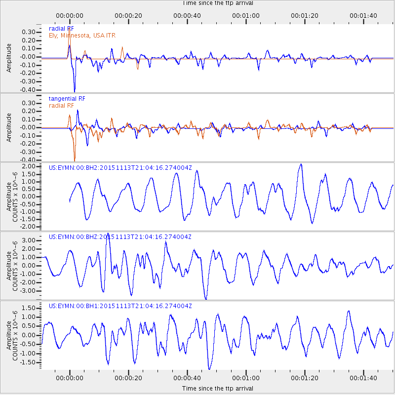
EYMN Ely, Minnesota, USA - Earthquake Result Viewer
*The percent match for this event was below the threshold and hence no stack was calculated.
| Earthquake location: |
Northwest Of Ryukyu Islands |
| Earthquake latitude/longitude: |
31.1/128.8 |
| Earthquake time(UTC): |
2015/11/13 (317) 20:51:32 GMT |
| Earthquake Depth: |
10 km |
| Earthquake Magnitude: |
6.5 MWB |
| Earthquake Catalog/Contributor: |
NEIC PDE/NEIC COMCAT |
|
| Network: |
US United States National Seismic Network |
| Station: |
EYMN Ely, Minnesota, USA |
| Lat/Lon: |
47.95 N/91.50 W |
| Elevation: |
475 m |
|
| Distance: |
93.4 deg |
| Az: |
25.831 deg |
| Baz: |
326.208 deg |
| Ray Param: |
$rayparam |
*The percent match for this event was below the threshold and hence was not used in the summary stack. |
|
| Radial Match: |
83.13393 % |
| Radial Bump: |
296 |
| Transverse Match: |
86.38288 % |
| Transverse Bump: |
212 |
| SOD ConfigId: |
1259291 |
| Insert Time: |
2015-11-27 21:12:16.765 +0000 |
| GWidth: |
2.5 |
| Max Bumps: |
400 |
| Tol: |
0.001 |
|
Signal To Noise
| Channel | StoN | STA | LTA |
| US:EYMN:00:BHZ:20151113T21:04:16.274004Z | 1.651825 | 1.6484241E-6 | 9.979411E-7 |
| US:EYMN:00:BH1:20151113T21:04:16.274004Z | 0.5521675 | 3.2369155E-7 | 5.8621987E-7 |
| US:EYMN:00:BH2:20151113T21:04:16.274004Z | 0.8528127 | 6.132286E-7 | 7.1906607E-7 |
| Arrivals |
| Ps | |
| PpPs | |
| PsPs/PpSs | |


