You are here: Home > Network List > CN - Canadian National Seismograph Network Stations List
> Station INK INUVIK, NT > Earthquake Result Viewer
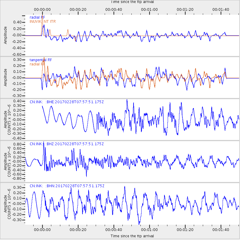
INK INUVIK, NT - Earthquake Result Viewer
*The percent match for this event was below the threshold and hence no stack was calculated.
| Earthquake location: |
Near East Coast Of Honshu, Japan |
| Earthquake latitude/longitude: |
37.6/141.3 |
| Earthquake time(UTC): |
2017/02/28 (059) 07:49:01 GMT |
| Earthquake Depth: |
38 km |
| Earthquake Magnitude: |
5.7 Mww |
| Earthquake Catalog/Contributor: |
NEIC PDE/us |
|
| Network: |
CN Canadian National Seismograph Network |
| Station: |
INK INUVIK, NT |
| Lat/Lon: |
68.31 N/133.53 W |
| Elevation: |
44 m |
|
| Distance: |
54.0 deg |
| Az: |
27.271 deg |
| Baz: |
281.679 deg |
| Ray Param: |
$rayparam |
*The percent match for this event was below the threshold and hence was not used in the summary stack. |
|
| Radial Match: |
53.659695 % |
| Radial Bump: |
400 |
| Transverse Match: |
49.62813 % |
| Transverse Bump: |
400 |
| SOD ConfigId: |
11737051 |
| Insert Time: |
2019-04-26 20:24:57.682 +0000 |
| GWidth: |
2.5 |
| Max Bumps: |
400 |
| Tol: |
0.001 |
|
Signal To Noise
| Channel | StoN | STA | LTA |
| CN:INK: :BHZ:20170228T07:57:51.175Z | 2.2668607 | 3.5185374E-7 | 1.552163E-7 |
| CN:INK: :BHN:20170228T07:57:51.175Z | 1.2143166 | 1.3646229E-7 | 1.1237785E-7 |
| CN:INK: :BHE:20170228T07:57:51.175Z | 1.2127637 | 1.6221439E-7 | 1.3375598E-7 |
| Arrivals |
| Ps | |
| PpPs | |
| PsPs/PpSs | |


