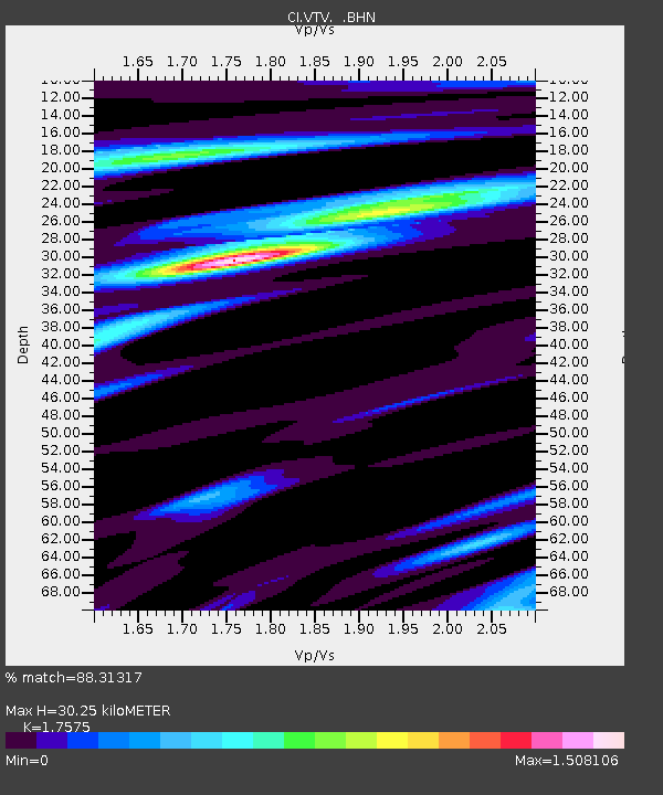
VTV Victorville, California, USA - Earthquake Result Viewer

Earthquake location: Fox Islands, Aleutian Islands
Earthquake latitude/longitude: 52.9/-169.1
Earthquake time(UTC): 1999/01/28 (028) 08:10:05 GMT
Earthquake Depth: 67 km
Earthquake Magnitude: 6.3 MB, 6.1 MS, 6.6 MW, 6.6 ME
Earthquake Catalog/Contributor: WHDF/NEIC
Network: CI Caltech Regional Seismic Network
Station: VTV Victorville, California, USA
Lat/Lon: 34.56 N/117.33 W
Elevation: 812 m
Distance: 40.7 deg
Az: 95.624 deg
Baz: 313.053 deg
Ray Param: 0.074063495
Estimated Moho Depth: 30.25 km
Estimated Crust Vp/Vs: 1.76
Assumed Crust Vp: 6.276 km/s
Estimated Crust Vs: 3.571 km/s
Estimated Crust Poisson's Ratio: 0.26
Radial Match: 88.31317 %
Radial Bump: 299
Transverse Match: 72.78838 %
Transverse Bump: 400
SOD ConfigId: 4770
Insert Time: 2010-03-05 22:16:48.671 +0000
GWidth: 2.5
Max Bumps: 400
Tol: 0.001

Signal To Noise

ChannelStoNSTALTA
CI:VTV: :BHN:19990128T08:17:08.711992Z2.79680948.1407944E-72.9107434E-7
CI:VTV: :BHE:19990128T08:17:08.711992Z3.44676618.9016874E-72.58262E-7
CI:VTV: :BHZ:19990128T08:17:08.711992Z13.1445742.1802061E-61.6586358E-7
Arrivals
Ps3.9 SECOND
PpPs12 SECOND
PsPs/PpSs16 SECOND