You are here: Home > Network List > TA - USArray Transportable Network (new EarthScope stations) Stations List
> Station H24K Noodor Dome, AK, USA > Earthquake Result Viewer
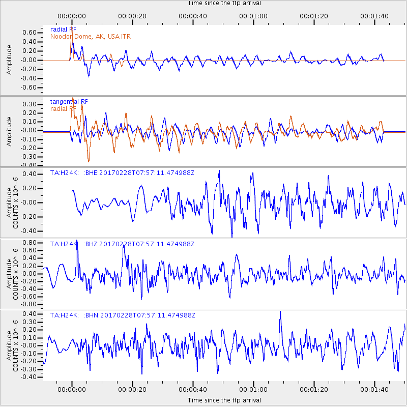
H24K Noodor Dome, AK, USA - Earthquake Result Viewer
*The percent match for this event was below the threshold and hence no stack was calculated.
| Earthquake location: |
Near East Coast Of Honshu, Japan |
| Earthquake latitude/longitude: |
37.6/141.3 |
| Earthquake time(UTC): |
2017/02/28 (059) 07:49:01 GMT |
| Earthquake Depth: |
38 km |
| Earthquake Magnitude: |
5.7 Mww |
| Earthquake Catalog/Contributor: |
NEIC PDE/us |
|
| Network: |
TA USArray Transportable Network (new EarthScope stations) |
| Station: |
H24K Noodor Dome, AK, USA |
| Lat/Lon: |
65.84 N/147.88 W |
| Elevation: |
814 m |
|
| Distance: |
48.6 deg |
| Az: |
31.195 deg |
| Baz: |
270.917 deg |
| Ray Param: |
$rayparam |
*The percent match for this event was below the threshold and hence was not used in the summary stack. |
|
| Radial Match: |
71.71437 % |
| Radial Bump: |
400 |
| Transverse Match: |
60.92625 % |
| Transverse Bump: |
400 |
| SOD ConfigId: |
11737051 |
| Insert Time: |
2019-04-26 20:30:17.227 +0000 |
| GWidth: |
2.5 |
| Max Bumps: |
400 |
| Tol: |
0.001 |
|
Signal To Noise
| Channel | StoN | STA | LTA |
| TA:H24K: :BHZ:20170228T07:57:11.474988Z | 2.6792223 | 2.881639E-7 | 1.0755505E-7 |
| TA:H24K: :BHN:20170228T07:57:11.474988Z | 0.5846518 | 5.0207177E-8 | 8.587535E-8 |
| TA:H24K: :BHE:20170228T07:57:11.474988Z | 1.3349826 | 1.3547248E-7 | 1.01478825E-7 |
| Arrivals |
| Ps | |
| PpPs | |
| PsPs/PpSs | |


