You are here: Home > Network List > TJ - Tajikistan National Seismic Network Stations List
> Station GARM Garm, Tajikistan > Earthquake Result Viewer
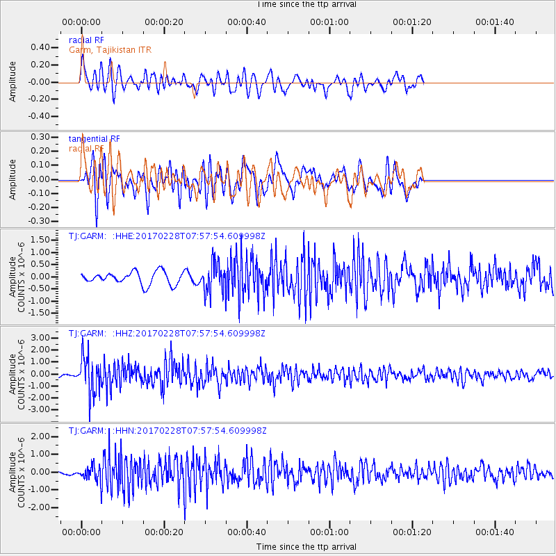
GARM Garm, Tajikistan - Earthquake Result Viewer
*The percent match for this event was below the threshold and hence no stack was calculated.
| Earthquake location: |
Near East Coast Of Honshu, Japan |
| Earthquake latitude/longitude: |
37.6/141.3 |
| Earthquake time(UTC): |
2017/02/28 (059) 07:49:01 GMT |
| Earthquake Depth: |
38 km |
| Earthquake Magnitude: |
5.7 Mww |
| Earthquake Catalog/Contributor: |
NEIC PDE/us |
|
| Network: |
TJ Tajikistan National Seismic Network |
| Station: |
GARM Garm, Tajikistan |
| Lat/Lon: |
39.00 N/70.32 E |
| Elevation: |
1305 m |
|
| Distance: |
54.4 deg |
| Az: |
295.024 deg |
| Baz: |
67.525 deg |
| Ray Param: |
$rayparam |
*The percent match for this event was below the threshold and hence was not used in the summary stack. |
|
| Radial Match: |
66.811005 % |
| Radial Bump: |
400 |
| Transverse Match: |
73.096756 % |
| Transverse Bump: |
400 |
| SOD ConfigId: |
11737051 |
| Insert Time: |
2019-04-26 20:30:57.744 +0000 |
| GWidth: |
2.5 |
| Max Bumps: |
400 |
| Tol: |
0.001 |
|
Signal To Noise
| Channel | StoN | STA | LTA |
| TJ:GARM: :HHZ:20170228T07:57:54.609998Z | 6.5000668 | 1.5823688E-6 | 2.4343885E-7 |
| TJ:GARM: :HHN:20170228T07:57:54.609998Z | 2.3646276 | 4.1176142E-7 | 1.7413372E-7 |
| TJ:GARM: :HHE:20170228T07:57:54.609998Z | 2.4116223 | 6.167561E-7 | 2.5574323E-7 |
| Arrivals |
| Ps | |
| PpPs | |
| PsPs/PpSs | |


