You are here: Home > Network List > US - United States National Seismic Network Stations List
> Station ELK Elko, Nevada, USA > Earthquake Result Viewer
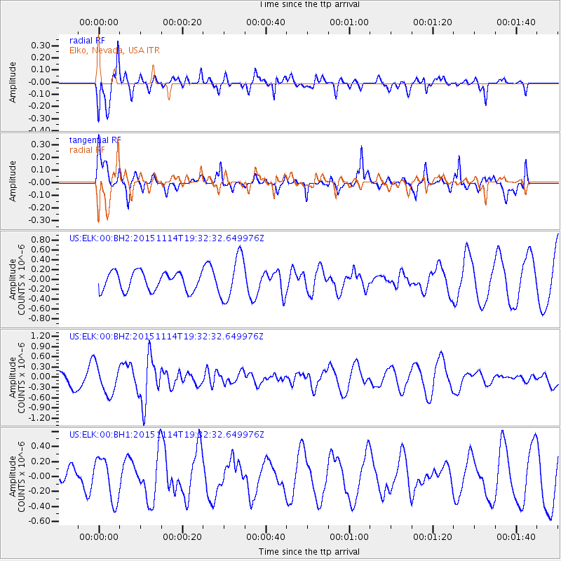
ELK Elko, Nevada, USA - Earthquake Result Viewer
*The percent match for this event was below the threshold and hence no stack was calculated.
| Earthquake location: |
Northwest Of Ryukyu Islands |
| Earthquake latitude/longitude: |
31.4/129.0 |
| Earthquake time(UTC): |
2015/11/14 (318) 19:20:21 GMT |
| Earthquake Depth: |
26 km |
| Earthquake Magnitude: |
5.7 MB |
| Earthquake Catalog/Contributor: |
NEIC PDE/NEIC ALERT |
|
| Network: |
US United States National Seismic Network |
| Station: |
ELK Elko, Nevada, USA |
| Lat/Lon: |
40.74 N/115.24 W |
| Elevation: |
2210 m |
|
| Distance: |
86.9 deg |
| Az: |
43.24 deg |
| Baz: |
309.577 deg |
| Ray Param: |
$rayparam |
*The percent match for this event was below the threshold and hence was not used in the summary stack. |
|
| Radial Match: |
72.63227 % |
| Radial Bump: |
345 |
| Transverse Match: |
79.43208 % |
| Transverse Bump: |
362 |
| SOD ConfigId: |
1259291 |
| Insert Time: |
2015-11-28 21:20:46.334 +0000 |
| GWidth: |
2.5 |
| Max Bumps: |
400 |
| Tol: |
0.001 |
|
Signal To Noise
| Channel | StoN | STA | LTA |
| US:ELK:00:BHZ:20151114T19:32:32.649976Z | 1.0324652 | 4.032516E-7 | 3.905716E-7 |
| US:ELK:00:BH1:20151114T19:32:32.649976Z | 3.0113614 | 2.888967E-7 | 9.5935576E-8 |
| US:ELK:00:BH2:20151114T19:32:32.649976Z | 2.4318771 | 4.486529E-7 | 1.844883E-7 |
| Arrivals |
| Ps | |
| PpPs | |
| PsPs/PpSs | |


