You are here: Home > Network List > TA - USArray Transportable Network (new EarthScope stations) Stations List
> Station MSTX Muleshoe, TX, USA > Earthquake Result Viewer
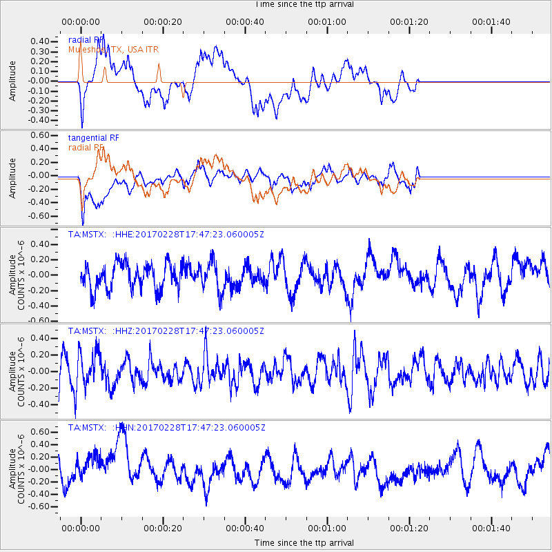
MSTX Muleshoe, TX, USA - Earthquake Result Viewer
*The percent match for this event was below the threshold and hence no stack was calculated.
| Earthquake location: |
Off Coast Of Southern Chile |
| Earthquake latitude/longitude: |
-44.8/-80.9 |
| Earthquake time(UTC): |
2017/02/28 (059) 17:35:40 GMT |
| Earthquake Depth: |
10 km |
| Earthquake Magnitude: |
5.6 Mww |
| Earthquake Catalog/Contributor: |
NEIC PDE/us |
|
| Network: |
TA USArray Transportable Network (new EarthScope stations) |
| Station: |
MSTX Muleshoe, TX, USA |
| Lat/Lon: |
33.97 N/102.77 W |
| Elevation: |
1167 m |
|
| Distance: |
80.8 deg |
| Az: |
341.738 deg |
| Baz: |
164.419 deg |
| Ray Param: |
$rayparam |
*The percent match for this event was below the threshold and hence was not used in the summary stack. |
|
| Radial Match: |
45.7446 % |
| Radial Bump: |
400 |
| Transverse Match: |
58.992744 % |
| Transverse Bump: |
400 |
| SOD ConfigId: |
11737051 |
| Insert Time: |
2019-04-26 20:39:05.798 +0000 |
| GWidth: |
2.5 |
| Max Bumps: |
400 |
| Tol: |
0.001 |
|
Signal To Noise
| Channel | StoN | STA | LTA |
| TA:MSTX: :HHZ:20170228T17:47:23.060005Z | 1.1973912 | 2.1581059E-7 | 1.80234E-7 |
| TA:MSTX: :HHN:20170228T17:47:23.060005Z | 1.0419743 | 2.5665972E-7 | 2.4632058E-7 |
| TA:MSTX: :HHE:20170228T17:47:23.060005Z | 1.2547246 | 2.0455987E-7 | 1.6303169E-7 |
| Arrivals |
| Ps | |
| PpPs | |
| PsPs/PpSs | |


