You are here: Home > Network List > G - GEOSCOPE Stations List
> Station MPG Montagne des Peres, French Guyana > Earthquake Result Viewer
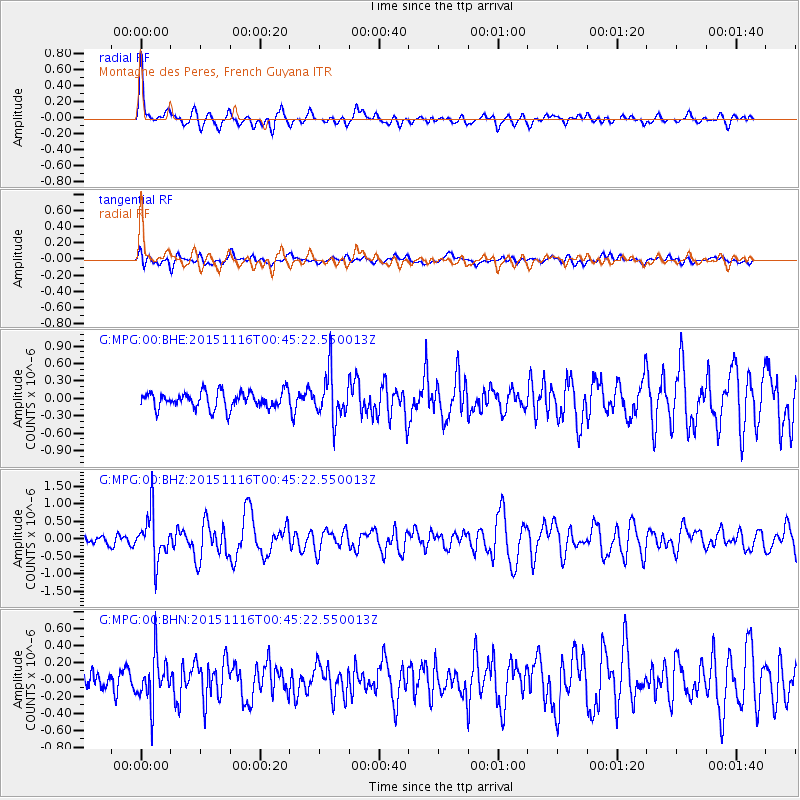
MPG Montagne des Peres, French Guyana - Earthquake Result Viewer
*The percent match for this event was below the threshold and hence no stack was calculated.
| Earthquake location: |
North Of Honduras |
| Earthquake latitude/longitude: |
17.8/-81.8 |
| Earthquake time(UTC): |
2015/11/16 (320) 00:39:33 GMT |
| Earthquake Depth: |
9.1 km |
| Earthquake Magnitude: |
5.8 MWP |
| Earthquake Catalog/Contributor: |
NEIC PDE/NEIC COMCAT |
|
| Network: |
G GEOSCOPE |
| Station: |
MPG Montagne des Peres, French Guyana |
| Lat/Lon: |
5.11 N/52.64 W |
| Elevation: |
147 m |
|
| Distance: |
31.2 deg |
| Az: |
110.387 deg |
| Baz: |
296.319 deg |
| Ray Param: |
$rayparam |
*The percent match for this event was below the threshold and hence was not used in the summary stack. |
|
| Radial Match: |
75.07903 % |
| Radial Bump: |
400 |
| Transverse Match: |
58.171577 % |
| Transverse Bump: |
400 |
| SOD ConfigId: |
1259291 |
| Insert Time: |
2015-11-30 01:35:33.084 +0000 |
| GWidth: |
2.5 |
| Max Bumps: |
400 |
| Tol: |
0.001 |
|
Signal To Noise
| Channel | StoN | STA | LTA |
| G:MPG:00:BHZ:20151116T00:45:22.550013Z | 4.4321413 | 6.649435E-7 | 1.5002759E-7 |
| G:MPG:00:BHN:20151116T00:45:22.550013Z | 2.5345104 | 2.7673065E-7 | 1.0918506E-7 |
| G:MPG:00:BHE:20151116T00:45:22.550013Z | 2.8197572 | 4.0108912E-7 | 1.4224243E-7 |
| Arrivals |
| Ps | |
| PpPs | |
| PsPs/PpSs | |


