You are here: Home > Network List > IU - Global Seismograph Network (GSN - IRIS/USGS) Stations List
> Station RSSD Black Hills, South Dakota, USA > Earthquake Result Viewer
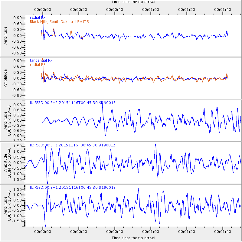
RSSD Black Hills, South Dakota, USA - Earthquake Result Viewer
*The percent match for this event was below the threshold and hence no stack was calculated.
| Earthquake location: |
North Of Honduras |
| Earthquake latitude/longitude: |
17.8/-81.8 |
| Earthquake time(UTC): |
2015/11/16 (320) 00:39:33 GMT |
| Earthquake Depth: |
9.1 km |
| Earthquake Magnitude: |
5.8 MWP |
| Earthquake Catalog/Contributor: |
NEIC PDE/NEIC COMCAT |
|
| Network: |
IU Global Seismograph Network (GSN - IRIS/USGS) |
| Station: |
RSSD Black Hills, South Dakota, USA |
| Lat/Lon: |
44.12 N/104.04 W |
| Elevation: |
2090 m |
|
| Distance: |
32.2 deg |
| Az: |
329.27 deg |
| Baz: |
137.483 deg |
| Ray Param: |
$rayparam |
*The percent match for this event was below the threshold and hence was not used in the summary stack. |
|
| Radial Match: |
77.33653 % |
| Radial Bump: |
400 |
| Transverse Match: |
73.8171 % |
| Transverse Bump: |
400 |
| SOD ConfigId: |
1259291 |
| Insert Time: |
2015-11-30 01:36:28.511 +0000 |
| GWidth: |
2.5 |
| Max Bumps: |
400 |
| Tol: |
0.001 |
|
Signal To Noise
| Channel | StoN | STA | LTA |
| IU:RSSD:00:BHZ:20151116T00:45:30.919001Z | 5.3848324 | 8.9944905E-7 | 1.670338E-7 |
| IU:RSSD:00:BH1:20151116T00:45:30.919001Z | 8.971845 | 8.594861E-7 | 9.5798136E-8 |
| IU:RSSD:00:BH2:20151116T00:45:30.919001Z | 3.9498897 | 5.0181416E-7 | 1.2704511E-7 |
| Arrivals |
| Ps | |
| PpPs | |
| PsPs/PpSs | |


