You are here: Home > Network List > US - United States National Seismic Network Stations List
> Station HAWA Hanford, Washington, USA > Earthquake Result Viewer
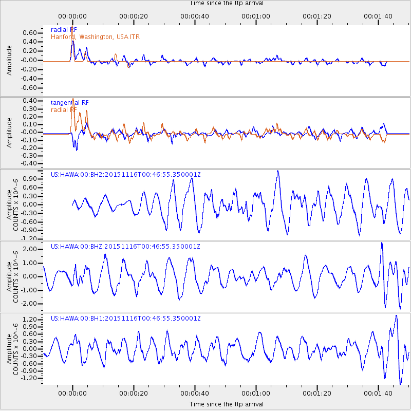
HAWA Hanford, Washington, USA - Earthquake Result Viewer
*The percent match for this event was below the threshold and hence no stack was calculated.
| Earthquake location: |
North Of Honduras |
| Earthquake latitude/longitude: |
17.8/-81.8 |
| Earthquake time(UTC): |
2015/11/16 (320) 00:39:33 GMT |
| Earthquake Depth: |
9.1 km |
| Earthquake Magnitude: |
5.8 MWP |
| Earthquake Catalog/Contributor: |
NEIC PDE/NEIC COMCAT |
|
| Network: |
US United States National Seismic Network |
| Station: |
HAWA Hanford, Washington, USA |
| Lat/Lon: |
46.39 N/119.53 W |
| Elevation: |
364 m |
|
| Distance: |
42.1 deg |
| Az: |
320.895 deg |
| Baz: |
119.773 deg |
| Ray Param: |
$rayparam |
*The percent match for this event was below the threshold and hence was not used in the summary stack. |
|
| Radial Match: |
69.99923 % |
| Radial Bump: |
400 |
| Transverse Match: |
68.74923 % |
| Transverse Bump: |
391 |
| SOD ConfigId: |
1259291 |
| Insert Time: |
2015-11-30 01:38:48.496 +0000 |
| GWidth: |
2.5 |
| Max Bumps: |
400 |
| Tol: |
0.001 |
|
Signal To Noise
| Channel | StoN | STA | LTA |
| US:HAWA:00:BHZ:20151116T00:46:55.350001Z | 0.78093743 | 4.7669448E-7 | 6.1041317E-7 |
| US:HAWA:00:BH1:20151116T00:46:55.350001Z | 1.4922448 | 4.017274E-7 | 2.692101E-7 |
| US:HAWA:00:BH2:20151116T00:46:55.350001Z | 2.7353792 | 5.417267E-7 | 1.9804446E-7 |
| Arrivals |
| Ps | |
| PpPs | |
| PsPs/PpSs | |


