You are here: Home > Network List > UU - University of Utah Regional Network Stations List
> Station KNB Kanab, UT, USA > Earthquake Result Viewer
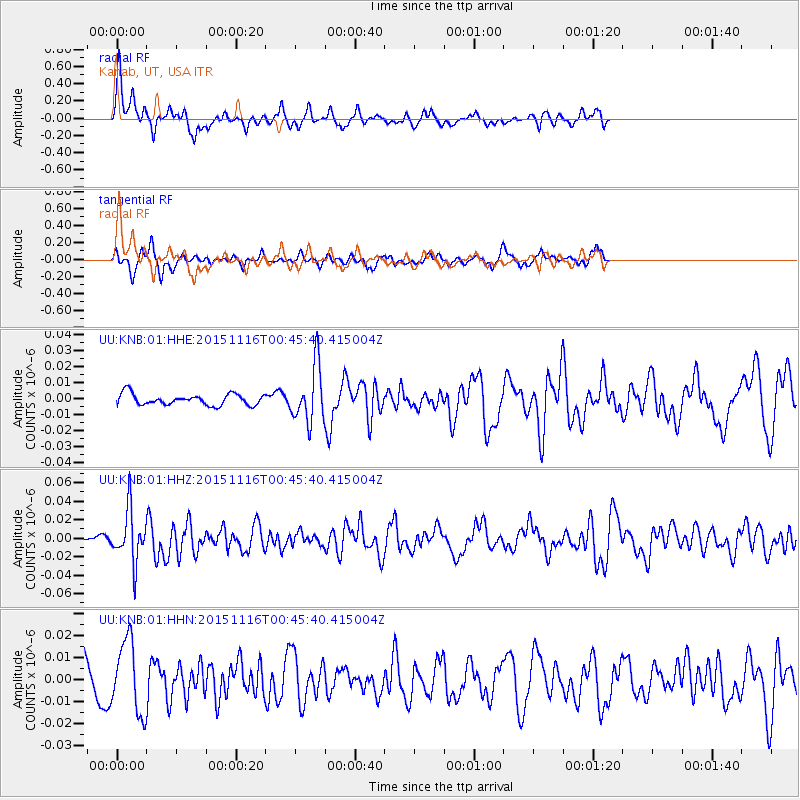
KNB Kanab, UT, USA - Earthquake Result Viewer
*The percent match for this event was below the threshold and hence no stack was calculated.
| Earthquake location: |
North Of Honduras |
| Earthquake latitude/longitude: |
17.8/-81.8 |
| Earthquake time(UTC): |
2015/11/16 (320) 00:39:33 GMT |
| Earthquake Depth: |
9.1 km |
| Earthquake Magnitude: |
5.8 MWP |
| Earthquake Catalog/Contributor: |
NEIC PDE/NEIC COMCAT |
|
| Network: |
UU University of Utah Regional Network |
| Station: |
KNB Kanab, UT, USA |
| Lat/Lon: |
37.02 N/112.82 W |
| Elevation: |
1715 m |
|
| Distance: |
33.3 deg |
| Az: |
311.301 deg |
| Baz: |
116.618 deg |
| Ray Param: |
$rayparam |
*The percent match for this event was below the threshold and hence was not used in the summary stack. |
|
| Radial Match: |
71.25974 % |
| Radial Bump: |
331 |
| Transverse Match: |
76.1669 % |
| Transverse Bump: |
368 |
| SOD ConfigId: |
1259291 |
| Insert Time: |
2015-11-30 01:39:51.978 +0000 |
| GWidth: |
2.5 |
| Max Bumps: |
400 |
| Tol: |
0.001 |
|
Signal To Noise
| Channel | StoN | STA | LTA |
| UU:KNB:01:HHZ:20151116T00:45:40.415004Z | 5.5745506 | 2.7775592E-8 | 4.9825704E-9 |
| UU:KNB:01:HHN:20151116T00:45:40.415004Z | 1.9328896 | 1.6215449E-8 | 8.389226E-9 |
| UU:KNB:01:HHE:20151116T00:45:40.415004Z | 5.022161 | 1.7584204E-8 | 3.5013223E-9 |
| Arrivals |
| Ps | |
| PpPs | |
| PsPs/PpSs | |


