You are here: Home > Network List > TA - USArray Transportable Network (new EarthScope stations) Stations List
> Station F26K Sheenjek River, AK, USA > Earthquake Result Viewer
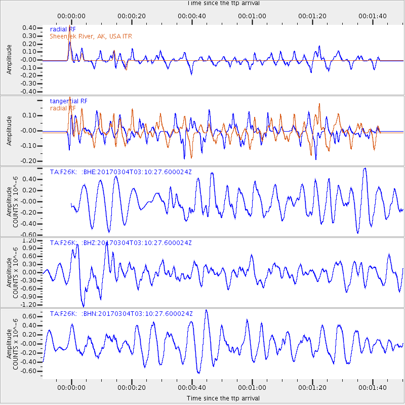
F26K Sheenjek River, AK, USA - Earthquake Result Viewer
*The percent match for this event was below the threshold and hence no stack was calculated.
| Earthquake location: |
Solomon Islands |
| Earthquake latitude/longitude: |
-7.4/155.7 |
| Earthquake time(UTC): |
2017/03/04 (063) 02:58:24 GMT |
| Earthquake Depth: |
54 km |
| Earthquake Magnitude: |
5.9 Mww |
| Earthquake Catalog/Contributor: |
NEIC PDE/us |
|
| Network: |
TA USArray Transportable Network (new EarthScope stations) |
| Station: |
F26K Sheenjek River, AK, USA |
| Lat/Lon: |
67.69 N/144.15 W |
| Elevation: |
683 m |
|
| Distance: |
85.9 deg |
| Az: |
19.385 deg |
| Baz: |
239.594 deg |
| Ray Param: |
$rayparam |
*The percent match for this event was below the threshold and hence was not used in the summary stack. |
|
| Radial Match: |
44.34724 % |
| Radial Bump: |
354 |
| Transverse Match: |
58.286186 % |
| Transverse Bump: |
400 |
| SOD ConfigId: |
11737051 |
| Insert Time: |
2019-04-26 21:16:02.345 +0000 |
| GWidth: |
2.5 |
| Max Bumps: |
400 |
| Tol: |
0.001 |
|
Signal To Noise
| Channel | StoN | STA | LTA |
| TA:F26K: :BHZ:20170304T03:10:27.600024Z | 5.0363517 | 7.847761E-7 | 1.5582233E-7 |
| TA:F26K: :BHN:20170304T03:10:27.600024Z | 0.76980174 | 2.207187E-7 | 2.867215E-7 |
| TA:F26K: :BHE:20170304T03:10:27.600024Z | 0.48260698 | 1.2555844E-7 | 2.6016707E-7 |
| Arrivals |
| Ps | |
| PpPs | |
| PsPs/PpSs | |


