You are here: Home > Network List > TA - USArray Transportable Network (new EarthScope stations) Stations List
> Station L20K Farewell, AK, USA > Earthquake Result Viewer
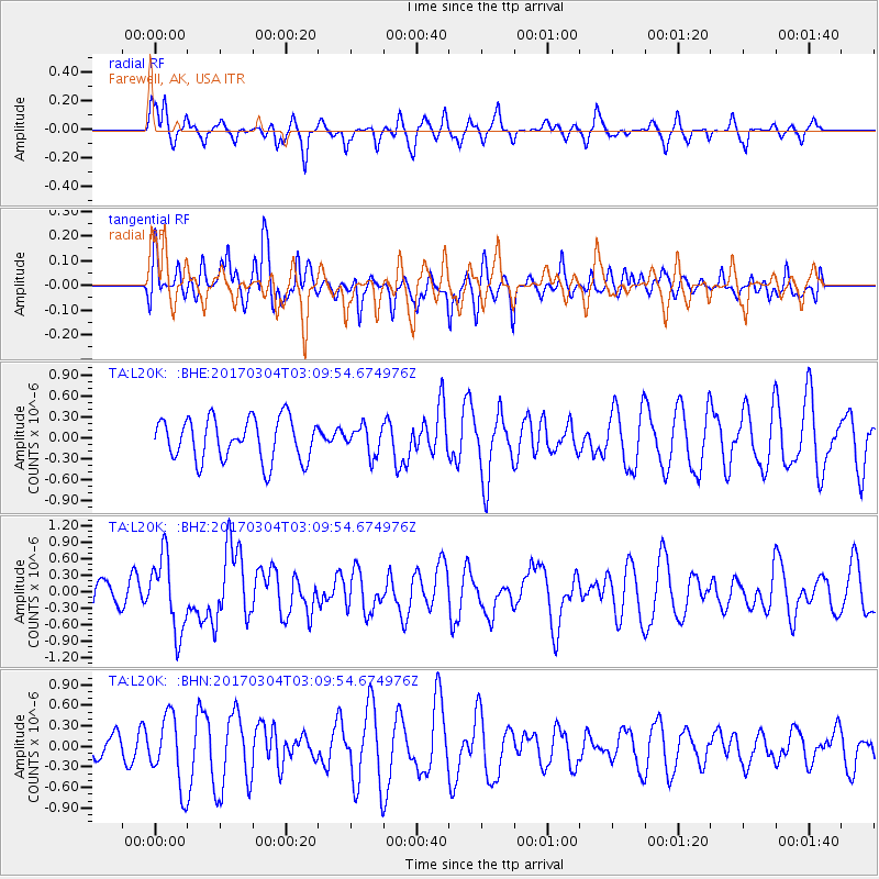
L20K Farewell, AK, USA - Earthquake Result Viewer
*The percent match for this event was below the threshold and hence no stack was calculated.
| Earthquake location: |
Solomon Islands |
| Earthquake latitude/longitude: |
-7.4/155.7 |
| Earthquake time(UTC): |
2017/03/04 (063) 02:58:24 GMT |
| Earthquake Depth: |
54 km |
| Earthquake Magnitude: |
5.9 Mww |
| Earthquake Catalog/Contributor: |
NEIC PDE/us |
|
| Network: |
TA USArray Transportable Network (new EarthScope stations) |
| Station: |
L20K Farewell, AK, USA |
| Lat/Lon: |
62.48 N/153.88 W |
| Elevation: |
673 m |
|
| Distance: |
79.6 deg |
| Az: |
21.347 deg |
| Baz: |
231.011 deg |
| Ray Param: |
$rayparam |
*The percent match for this event was below the threshold and hence was not used in the summary stack. |
|
| Radial Match: |
53.027275 % |
| Radial Bump: |
344 |
| Transverse Match: |
35.546707 % |
| Transverse Bump: |
400 |
| SOD ConfigId: |
11737051 |
| Insert Time: |
2019-04-26 21:16:18.643 +0000 |
| GWidth: |
2.5 |
| Max Bumps: |
400 |
| Tol: |
0.001 |
|
Signal To Noise
| Channel | StoN | STA | LTA |
| TA:L20K: :BHZ:20170304T03:09:54.674976Z | 2.088233 | 6.7589144E-7 | 3.2366665E-7 |
| TA:L20K: :BHN:20170304T03:09:54.674976Z | 1.3798681 | 5.116193E-7 | 3.7077405E-7 |
| TA:L20K: :BHE:20170304T03:09:54.674976Z | 0.70765555 | 2.1372833E-7 | 3.0202312E-7 |
| Arrivals |
| Ps | |
| PpPs | |
| PsPs/PpSs | |


