You are here: Home > Network List > UW - Pacific Northwest Regional Seismic Network Stations List
> Station MRBL Marblemount, WA, USA > Earthquake Result Viewer
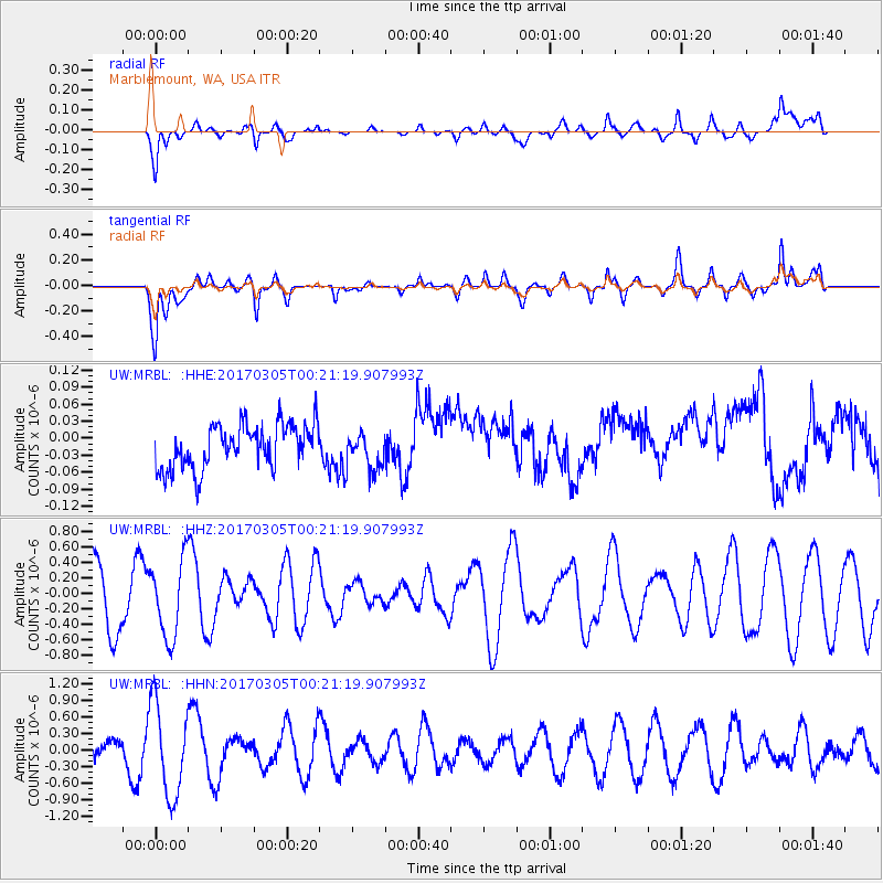
MRBL Marblemount, WA, USA - Earthquake Result Viewer
*The percent match for this event was below the threshold and hence no stack was calculated.
| Earthquake location: |
Mindanao, Philippines |
| Earthquake latitude/longitude: |
9.8/125.5 |
| Earthquake time(UTC): |
2017/03/05 (064) 00:08:20 GMT |
| Earthquake Depth: |
20 km |
| Earthquake Magnitude: |
5.7 mb |
| Earthquake Catalog/Contributor: |
NEIC PDE/us |
|
| Network: |
UW Pacific Northwest Regional Seismic Network |
| Station: |
MRBL Marblemount, WA, USA |
| Lat/Lon: |
48.52 N/121.48 W |
| Elevation: |
75 m |
|
| Distance: |
97.4 deg |
| Az: |
38.122 deg |
| Baz: |
293.784 deg |
| Ray Param: |
$rayparam |
*The percent match for this event was below the threshold and hence was not used in the summary stack. |
|
| Radial Match: |
54.28898 % |
| Radial Bump: |
400 |
| Transverse Match: |
55.544373 % |
| Transverse Bump: |
400 |
| SOD ConfigId: |
11737051 |
| Insert Time: |
2019-04-26 21:22:30.839 +0000 |
| GWidth: |
2.5 |
| Max Bumps: |
400 |
| Tol: |
0.001 |
|
Signal To Noise
| Channel | StoN | STA | LTA |
| UW:MRBL: :HHZ:20170305T00:21:19.907993Z | 1.3015924 | 5.0160025E-7 | 3.853743E-7 |
| UW:MRBL: :HHN:20170305T00:21:19.907993Z | 3.653162 | 8.3879627E-7 | 2.2960829E-7 |
| UW:MRBL: :HHE:20170305T00:21:19.907993Z | 0.83370775 | 3.1676915E-8 | 3.799523E-8 |
| Arrivals |
| Ps | |
| PpPs | |
| PsPs/PpSs | |


