You are here: Home > Network List > TA - USArray Transportable Network (new EarthScope stations) Stations List
> Station MSTX Muleshoe, TX, USA > Earthquake Result Viewer
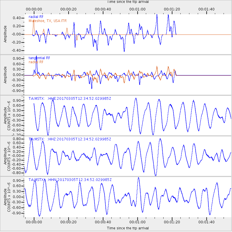
MSTX Muleshoe, TX, USA - Earthquake Result Viewer
*The percent match for this event was below the threshold and hence no stack was calculated.
| Earthquake location: |
Pacific-Antarctic Ridge |
| Earthquake latitude/longitude: |
-55.2/-129.2 |
| Earthquake time(UTC): |
2017/03/05 (064) 12:22:16 GMT |
| Earthquake Depth: |
10 km |
| Earthquake Magnitude: |
5.6 Mwb |
| Earthquake Catalog/Contributor: |
NEIC PDE/us |
|
| Network: |
TA USArray Transportable Network (new EarthScope stations) |
| Station: |
MSTX Muleshoe, TX, USA |
| Lat/Lon: |
33.97 N/102.77 W |
| Elevation: |
1167 m |
|
| Distance: |
91.6 deg |
| Az: |
21.699 deg |
| Baz: |
194.784 deg |
| Ray Param: |
$rayparam |
*The percent match for this event was below the threshold and hence was not used in the summary stack. |
|
| Radial Match: |
42.634228 % |
| Radial Bump: |
400 |
| Transverse Match: |
67.339134 % |
| Transverse Bump: |
348 |
| SOD ConfigId: |
11737051 |
| Insert Time: |
2019-04-26 21:27:53.641 +0000 |
| GWidth: |
2.5 |
| Max Bumps: |
400 |
| Tol: |
0.001 |
|
Signal To Noise
| Channel | StoN | STA | LTA |
| TA:MSTX: :HHZ:20170305T12:34:52.029985Z | 1.0253896 | 4.2729158E-7 | 4.1671146E-7 |
| TA:MSTX: :HHN:20170305T12:34:52.029985Z | 2.219063 | 7.112565E-7 | 3.2052108E-7 |
| TA:MSTX: :HHE:20170305T12:34:52.029985Z | 0.80774254 | 4.5031086E-7 | 5.57493E-7 |
| Arrivals |
| Ps | |
| PpPs | |
| PsPs/PpSs | |


