You are here: Home > Network List > GS - US Geological Survey Networks Stations List
> Station DEC06 Boomer, Decatur, IL, USA > Earthquake Result Viewer
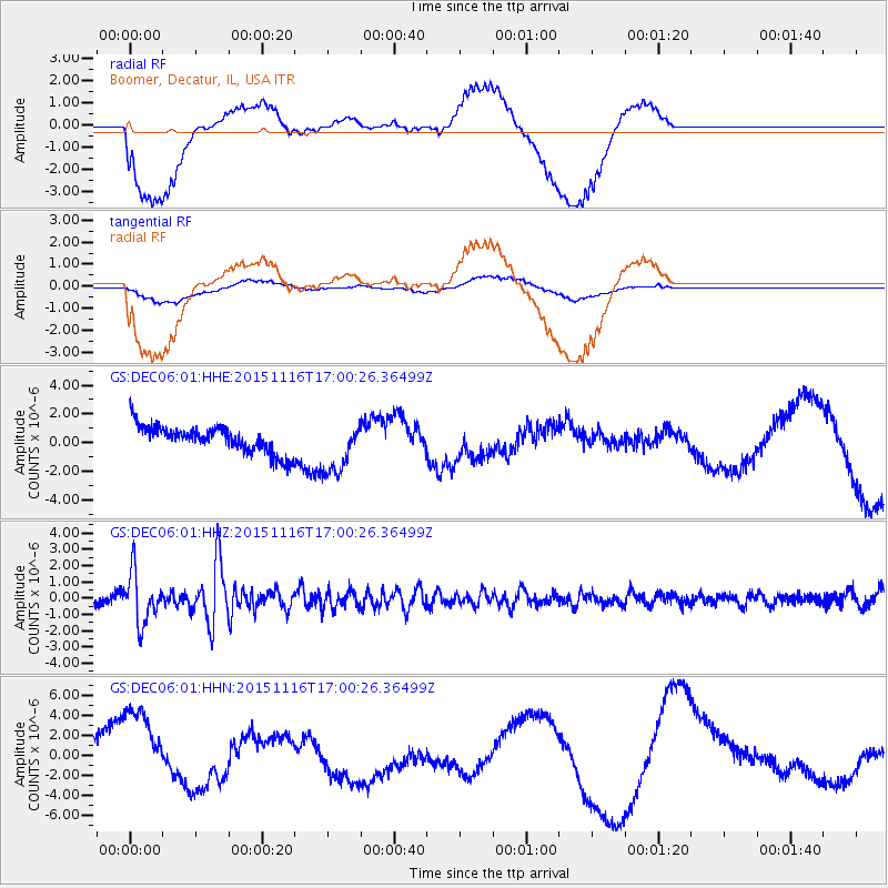
DEC06 Boomer, Decatur, IL, USA - Earthquake Result Viewer
*The percent match for this event was below the threshold and hence no stack was calculated.
| Earthquake location: |
Kuril Islands |
| Earthquake latitude/longitude: |
48.3/154.3 |
| Earthquake time(UTC): |
2015/11/16 (320) 16:49:15 GMT |
| Earthquake Depth: |
42 km |
| Earthquake Magnitude: |
5.8 MWB |
| Earthquake Catalog/Contributor: |
NEIC PDE/NEIC COMCAT |
|
| Network: |
GS US Geological Survey Networks |
| Station: |
DEC06 Boomer, Decatur, IL, USA |
| Lat/Lon: |
39.90 N/88.95 W |
| Elevation: |
215 m |
|
| Distance: |
75.9 deg |
| Az: |
45.085 deg |
| Baz: |
322.071 deg |
| Ray Param: |
$rayparam |
*The percent match for this event was below the threshold and hence was not used in the summary stack. |
|
| Radial Match: |
75.18801 % |
| Radial Bump: |
400 |
| Transverse Match: |
68.60002 % |
| Transverse Bump: |
400 |
| SOD ConfigId: |
1259291 |
| Insert Time: |
2015-11-30 17:42:47.237 +0000 |
| GWidth: |
2.5 |
| Max Bumps: |
400 |
| Tol: |
0.001 |
|
Signal To Noise
| Channel | StoN | STA | LTA |
| GS:DEC06:01:HHZ:20151116T17:00:26.36499Z | 5.075682 | 1.5244289E-6 | 3.0033968E-7 |
| GS:DEC06:01:HHN:20151116T17:00:26.36499Z | 3.6190455 | 4.1744347E-6 | 1.1534629E-6 |
| GS:DEC06:01:HHE:20151116T17:00:26.36499Z | 2.0236993 | 1.9022289E-6 | 9.39976E-7 |
| Arrivals |
| Ps | |
| PpPs | |
| PsPs/PpSs | |


