You are here: Home > Network List > TA - USArray Transportable Network (new EarthScope stations) Stations List
> Station F26K Sheenjek River, AK, USA > Earthquake Result Viewer
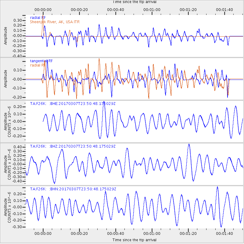
F26K Sheenjek River, AK, USA - Earthquake Result Viewer
*The percent match for this event was below the threshold and hence no stack was calculated.
| Earthquake location: |
Vanuatu Islands |
| Earthquake latitude/longitude: |
-15.0/168.2 |
| Earthquake time(UTC): |
2017/03/07 (066) 23:38:22 GMT |
| Earthquake Depth: |
8.0 km |
| Earthquake Magnitude: |
5.6 Mww |
| Earthquake Catalog/Contributor: |
NEIC PDE/us |
|
| Network: |
TA USArray Transportable Network (new EarthScope stations) |
| Station: |
F26K Sheenjek River, AK, USA |
| Lat/Lon: |
67.69 N/144.15 W |
| Elevation: |
683 m |
|
| Distance: |
89.4 deg |
| Az: |
16.399 deg |
| Baz: |
225.612 deg |
| Ray Param: |
$rayparam |
*The percent match for this event was below the threshold and hence was not used in the summary stack. |
|
| Radial Match: |
59.64505 % |
| Radial Bump: |
400 |
| Transverse Match: |
57.465546 % |
| Transverse Bump: |
345 |
| SOD ConfigId: |
11737051 |
| Insert Time: |
2019-04-26 21:53:18.584 +0000 |
| GWidth: |
2.5 |
| Max Bumps: |
400 |
| Tol: |
0.001 |
|
Signal To Noise
| Channel | StoN | STA | LTA |
| TA:F26K: :BHZ:20170307T23:50:48.175029Z | 0.69874316 | 1.0923461E-7 | 1.5633013E-7 |
| TA:F26K: :BHN:20170307T23:50:48.175029Z | 1.0175517 | 1.1746116E-7 | 1.1543508E-7 |
| TA:F26K: :BHE:20170307T23:50:48.175029Z | 1.9251695 | 1.7141309E-7 | 8.9037925E-8 |
| Arrivals |
| Ps | |
| PpPs | |
| PsPs/PpSs | |


