You are here: Home > Network List > IU - Global Seismograph Network (GSN - IRIS/USGS) Stations List
> Station PMG Port Moresby, New Guinea > Earthquake Result Viewer
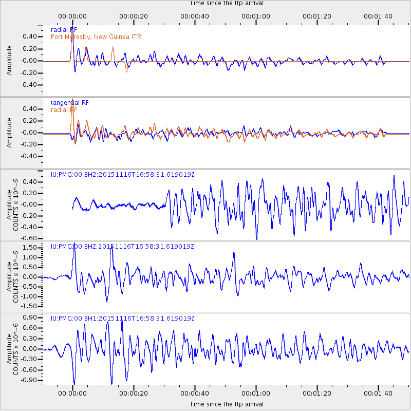
PMG Port Moresby, New Guinea - Earthquake Result Viewer
*The percent match for this event was below the threshold and hence no stack was calculated.
| Earthquake location: |
Kuril Islands |
| Earthquake latitude/longitude: |
48.3/154.3 |
| Earthquake time(UTC): |
2015/11/16 (320) 16:49:15 GMT |
| Earthquake Depth: |
42 km |
| Earthquake Magnitude: |
5.8 MWB |
| Earthquake Catalog/Contributor: |
NEIC PDE/NEIC COMCAT |
|
| Network: |
IU Global Seismograph Network (GSN - IRIS/USGS) |
| Station: |
PMG Port Moresby, New Guinea |
| Lat/Lon: |
9.40 S/147.16 E |
| Elevation: |
90 m |
|
| Distance: |
57.8 deg |
| Az: |
188.293 deg |
| Baz: |
5.602 deg |
| Ray Param: |
$rayparam |
*The percent match for this event was below the threshold and hence was not used in the summary stack. |
|
| Radial Match: |
79.11583 % |
| Radial Bump: |
400 |
| Transverse Match: |
75.07976 % |
| Transverse Bump: |
400 |
| SOD ConfigId: |
1259291 |
| Insert Time: |
2015-11-30 17:45:54.760 +0000 |
| GWidth: |
2.5 |
| Max Bumps: |
400 |
| Tol: |
0.001 |
|
Signal To Noise
| Channel | StoN | STA | LTA |
| IU:PMG:00:BHZ:20151116T16:58:31.619019Z | 10.1898 | 7.164522E-7 | 7.031072E-8 |
| IU:PMG:00:BH1:20151116T16:58:31.619019Z | 8.414654 | 4.4105533E-7 | 5.241515E-8 |
| IU:PMG:00:BH2:20151116T16:58:31.619019Z | 3.8985753 | 1.815129E-7 | 4.6558778E-8 |
| Arrivals |
| Ps | |
| PpPs | |
| PsPs/PpSs | |


